Monocular SLAM for Dynamic Areas: Understanding WildGS-SLAM and Gaussian Splatting Technology
The intersection of advanced computer vision and environmental monitoring represents a critical frontier in ecological data collection and real-time environmental assessment. Recent developments in monocular simultaneous localization and mapping (SLAM) technology, particularly through innovations like WildGS-SLAM utilizing Gaussian splatting, are reshaping how we capture and analyze dynamic natural environments. This breakthrough technology enables autonomous systems to navigate and map complex, moving ecosystems with unprecedented precision, offering new possibilities for biodiversity monitoring, disaster response coordination, and sustainable resource management across diverse ecological zones.
Understanding how these sophisticated visual mapping systems function in unpredictable natural settings provides crucial insights into the future of environmental technology integration. As ecological systems face increasing pressure from climate change and human activity, the ability to rapidly and accurately document environmental conditions becomes essential for informed policy decisions and conservation strategies. WildGS-SLAM represents a paradigm shift in how we can deploy intelligent systems to work alongside ecological research and environmental protection efforts.
What is Monocular SLAM Technology
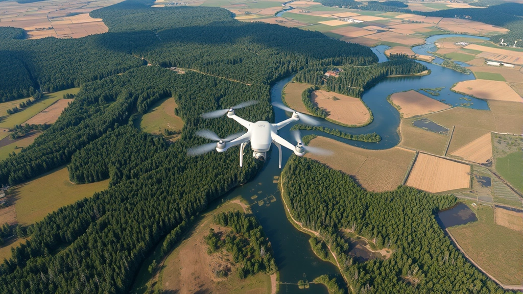
Simultaneous Localization and Mapping, commonly abbreviated as SLAM, represents one of the most significant advances in autonomous systems and robotics over the past two decades. Monocular SLAM specifically refers to systems that use a single camera to both determine their position in space and construct a three-dimensional map of their surroundings simultaneously. This dual functionality—localization and mapping—occurs in real-time, enabling robots, drones, and autonomous vehicles to navigate unknown territories without relying on external positioning systems like GPS.
Traditional SLAM systems often required multiple sensors—stereo cameras, depth sensors, or LiDAR units—making them expensive and computationally intensive. Monocular approaches democratize this technology by achieving comparable results with minimal hardware. The fundamental principle involves tracking distinctive visual features across successive camera frames, estimating the camera’s motion between frames, and progressively building a sparse or dense 3D representation of the environment. This process must handle numerous challenges including variable lighting conditions, motion blur, occlusions, and the inherent ambiguity of depth perception from a single viewpoint.
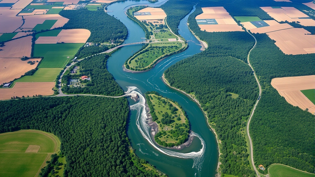
The relevance to types of environments becomes immediately apparent when considering ecological applications. Natural environments present unique challenges for traditional SLAM: dense vegetation obscures features, water surfaces create reflections, and dynamic elements like moving animals or blowing vegetation introduce temporal variability. These characteristics distinguish ecological SLAM requirements from the controlled indoor or urban settings where most traditional systems excel.
Understanding Gaussian Splatting in Environmental Contexts
Gaussian splatting emerged as a revolutionary rendering technique that represents 3D scenes through collections of Gaussian primitives rather than traditional polygon meshes or voxel grids. Each Gaussian is defined by a position, covariance matrix, and color, creating a flexible representation capable of capturing complex geometry and appearance with remarkable efficiency. Unlike mesh-based approaches requiring careful topology management or voxel methods demanding uniform resolution, Gaussian splatting adapts naturally to scene complexity.
In the context of environmental monitoring and ecological mapping, Gaussian splatting offers distinct advantages. The method excels at representing the intricate, organic structures found throughout natural environments—sprawling root systems, complex canopy structures, and irregular geological formations. The density of Gaussians can concentrate where detail matters most, efficiently representing sparse regions like open water or clear sky with minimal computational overhead. This adaptive representation directly addresses the economic efficiency concerns central to large-scale environmental monitoring programs, where computational resources constrain operational scope.
The technique originated in computer graphics research but has rapidly migrated toward practical applications in environmental sciences. By converting raw camera imagery into dense, continuous 3D representations, Gaussian splatting enables quantitative analysis of environmental features previously requiring manual measurement or expensive specialized equipment. Forest managers can assess canopy density and structure; hydrologists can map water surface dynamics; conservation biologists can document habitat complexity—all from standard video footage processed through Gaussian splatting pipelines.
” alt=”Dense forest ecosystem with layered vegetation structure and natural light filtering through canopy”>
WildGS-SLAM: Innovation in Dynamic Environment Mapping
WildGS-SLAM represents a sophisticated integration of monocular SLAM principles with Gaussian splatting technology, specifically engineered for performance in dynamic, unstructured natural environments. The system addresses a critical limitation of conventional SLAM approaches: their assumption of static scenes. Traditional methods struggle when significant portions of the environment change between consecutive frames—moving animals, wind-blown vegetation, flowing water, or clouds passing overhead. These dynamic elements violate the core assumptions underlying feature tracking and depth estimation, causing system failures or degraded performance.
The innovation in WildGS-SLAM involves implementing robust dynamic element segmentation while simultaneously maintaining accurate localization and dense scene reconstruction. The system employs sophisticated neural network architectures to distinguish between camera motion and environmental motion, allowing it to track stable structural elements while gracefully handling transient dynamic phenomena. This capability proves essential for real-world ecological monitoring, where dynamic elements represent not noise to be filtered but often the most ecologically significant information—animal behavior, vegetation movement, water dynamics.
From an ecological economics perspective, the ability to operate reliably in dynamic environments dramatically expands the application scope for autonomous monitoring systems. Rather than restricting deployment to controlled settings, WildGS-SLAM enables continuous monitoring across diverse environment examples ranging from active wildlife habitats to dynamic coastal zones. This expanded capability reduces the economic barriers to comprehensive environmental data collection, traditionally requiring extensive manual fieldwork or expensive specialized equipment. The cost-benefit analysis increasingly favors automated systems as their reliability and autonomy improve.
The technical architecture combines several key components: a monocular camera providing continuous visual input, a feature tracking module that identifies and follows distinctive points across frames while filtering dynamic elements, a localization engine that estimates camera pose from tracked features, and a Gaussian splatting renderer that converts feature observations into dense 3D scene representations. Real-time performance demands optimization across all components, often utilizing GPU acceleration and efficient data structures to maintain operational frame rates even with high-resolution input.
Applications in Ecological and Economic Systems
The intersection of advanced mapping technology and ecological monitoring creates compelling opportunities for sustainable resource management and environmental assessment. WildGS-SLAM and related technologies enable autonomous monitoring systems to document ecosystem conditions continuously, generating quantitative baseline data essential for detecting environmental changes and evaluating conservation interventions. This data-driven approach aligns with modern ecological economics principles emphasizing evidence-based policy and measurable outcomes.
Wildlife habitat assessment represents a primary application domain. Drones equipped with monocular cameras deploying WildGS-SLAM can traverse complex terrain, documenting habitat structure, vegetation composition, and spatial heterogeneity without disturbing sensitive wildlife. The resulting dense 3D reconstructions enable quantitative analysis of habitat complexity metrics previously requiring manual measurement. Conservation organizations can track habitat degradation, assess restoration effectiveness, and prioritize limited resources toward maximum ecological impact. The economic implications prove significant: reduced fieldwork requirements lower operational costs while improved data quality enhances decision-making precision.
Forest monitoring and carbon accounting represent another critical application. Accurate forest structure measurement—canopy height, biomass distribution, structural complexity—directly impacts carbon credit valuation and forest management planning. WildGS-SLAM-equipped systems can map forest structure at scales and resolutions previously requiring expensive LiDAR surveys. This technological democratization of forest monitoring capability enables smaller organizations and developing nations to participate in carbon markets and receive payment for ecosystem services, addressing equity concerns in global environmental economics.
The connection to human environment interaction becomes evident when considering how these technologies support sustainable development. By enabling accurate environmental monitoring and assessment, SLAM technologies provide the information foundation for environmentally-conscious economic development. Communities can document their environmental assets, quantify ecosystem services, and make informed decisions about resource utilization. This supports the transition toward definition of human environment interaction based on sustainable principles rather than exploitative extraction.
Water resource management and hydrological monitoring benefit substantially from these technologies. Autonomous systems can map water bodies, track water level changes, document riparian vegetation, and assess water quality indicators through visual analysis. In regions facing water scarcity or competing resource demands, this capability provides essential information for equitable water allocation and drought response planning. The economic value of improved water resource management extends through agricultural productivity, industrial water security, and human health outcomes.
Disaster response and environmental damage assessment represent high-impact applications. Following floods, wildfires, landslides, or storms, rapid environmental assessment determines appropriate response strategies and recovery priorities. WildGS-SLAM-equipped drones can quickly document damage extent and severity across difficult terrain, informing evacuation decisions, resource allocation, and recovery planning. The speed and comprehensiveness of automated assessment systems provide critical advantages in time-sensitive emergency situations where delayed information costs lives.
Challenges and Limitations in Real-World Deployment
Despite remarkable technical progress, significant challenges remain in deploying WildGS-SLAM and related systems across diverse ecological environments. The transition from controlled laboratory settings to unpredictable natural conditions reveals limitations requiring ongoing research and engineering refinement. Understanding these challenges provides realistic context for near-term technology deployment and identifies research priorities.
Computational constraints represent a fundamental limitation. While Gaussian splatting offers efficiency advantages over some alternatives, real-time performance demands substantial processing power. Deploying systems on resource-constrained platforms—small drones, mobile robots, edge devices—requires aggressive optimization. The tension between accuracy and computational efficiency becomes particularly acute in remote field deployments where power availability and processing capability remain limited. Research continues on efficient Gaussian splatting implementations and optimized SLAM algorithms, but practical constraints often force compromises between ideal performance and deployable capabilities.
Environmental lighting variations present persistent challenges. Natural environments experience dramatic lighting changes—shadows from clouds, sun angle variations throughout the day, dawn and dusk transitions, and weather-induced illumination shifts. These variations affect feature visibility and appearance, disrupting the visual tracking processes underlying SLAM systems. While robust feature detectors and descriptors help mitigate lighting sensitivity, challenging conditions—dense fog, heavy rain, or near-darkness—can degrade or disable system function. Seasonal variations in vegetation appearance and structure further complicate long-term deployment.
Dynamic element handling, while improved in WildGS-SLAM relative to conventional approaches, remains imperfect. Distinguishing between legitimate environmental motion and tracking artifacts proves difficult in scenarios with extensive dynamic activity. Dense animal populations, wind-driven vegetation, flowing water, and weather phenomena create complex motion patterns that challenge segmentation algorithms. Occasional misclassification of dynamic elements as static features can introduce artifacts in reconstructed scenes, while overly aggressive dynamic filtering may remove legitimate structural information.
The physical environment definition encompasses features that present specific technical challenges. Reflective surfaces including water bodies and wet vegetation create ambiguous visual features that confuse tracking algorithms. Transparent or semi-transparent elements like water, glass, and certain vegetation types violate assumptions underlying feature-based SLAM. Repetitive textures common in natural environments—grass fields, regular tree bark patterns, rock formations—create feature matching ambiguities that degrade localization precision.
Integration with existing ecological monitoring systems and workflows presents practical challenges. Many conservation organizations operate with limited technical expertise and infrastructure. Deploying novel technologies requires training, maintenance, data processing pipelines, and integration with existing databases and analysis workflows. The cost and effort of technology adoption must be weighed against benefits, and insufficient support infrastructure can prevent adoption despite technical capabilities.
Future Directions and Environmental Integration
The trajectory of SLAM technology and Gaussian splatting methods points toward increasingly capable systems suitable for diverse environmental applications. Ongoing research addresses current limitations while expanding functional capabilities, promising significant advances in the coming years. Understanding these future directions provides perspective on technology evolution and emerging opportunities.
Multi-modal sensor fusion represents a promising research direction. While monocular approaches offer advantages in simplicity and cost, combining visual information with other sensors—thermal imaging, spectral sensors, inertial measurement units—could enhance robustness and expand analytical capabilities. A system combining visible-light SLAM with thermal imaging could simultaneously document structure and temperature variations, valuable for assessing vegetation stress, detecting disease symptoms, or monitoring microclimatic variations. Spectral information could enable vegetation type classification and health assessment directly from SLAM data.
Improved dynamic element handling through advanced machine learning approaches shows significant promise. Transformer-based architectures and attention mechanisms are rapidly advancing, offering potential for more sophisticated scene understanding that better distinguishes between structural elements and dynamic phenomena. These advances could enable systems to selectively track dynamic elements—animal movement, water flow—as valuable data rather than problematic noise, extracting ecological information from previously problematic scenarios.
Integration with ecological models and decision support systems represents an important future direction. Raw 3D reconstructions provide valuable information, but extracting ecological insights requires analysis frameworks connecting visual data to ecological questions. Future systems might integrate SLAM data collection with real-time ecological analysis, automatically extracting relevant metrics and comparing observations against predictive models. This integration could enable adaptive monitoring systems that adjust data collection strategies based on emerging patterns.
Long-term autonomy and multi-robot systems offer substantial potential for large-scale environmental monitoring. Coordinated teams of autonomous systems could systematically survey large areas, with individual robots handling localization and mapping while sharing information to create comprehensive environmental models. This approach could enable comprehensive ecosystem monitoring at spatial scales currently impractical, providing the detailed baseline data essential for detecting and responding to environmental changes.
The broader context of environmental economics and sustainable development increasingly emphasizes the critical importance of high-quality environmental data. As documented by research from the World Bank’s environmental programs, accurate environmental assessment forms the foundation for effective policy and investment decisions. Technologies like WildGS-SLAM contribute to this data foundation by reducing monitoring costs and expanding geographic coverage, enabling more comprehensive environmental assessment supporting sustainable development goals.
Regulatory frameworks and environmental monitoring standards continue evolving to incorporate advanced technologies. As SLAM systems prove reliability and accuracy in ecological applications, regulatory agencies increasingly recognize them as legitimate tools for environmental assessment and monitoring. This institutional acceptance accelerates technology adoption and creates feedback loops where standardized application drives further technology refinement.
Climate change monitoring represents an increasingly critical application domain. Documenting environmental changes—vegetation shifts, water level changes, coastal erosion, glacier retreat—requires consistent, comparable data over extended periods. Autonomous SLAM systems offer potential for establishing long-term monitoring stations that continuously document environmental conditions with minimal maintenance requirements. These data streams could provide early warning of critical environmental changes and inform adaptive management strategies.

” alt=”Aerial view of mixed landscape showing forest patches, agricultural fields, water features, and natural habitat diversity from ecological monitoring perspective”>
FAQ
What specific advantages does WildGS-SLAM offer over traditional SLAM approaches for environmental monitoring?
WildGS-SLAM combines several advantages: monocular systems reduce hardware costs and complexity, Gaussian splatting provides efficient dense reconstruction, and explicit dynamic element handling enables operation in natural environments where motion is constant. These advantages translate to more deployable, cost-effective systems capable of functioning in real ecological settings rather than controlled environments.
How does Gaussian splatting differ from traditional 3D reconstruction methods like photogrammetry or point clouds?
Gaussian splatting represents scenes as collections of Gaussian primitives with adaptive density, offering efficiency advantages over dense point clouds while maintaining flexibility compared to rigid mesh models. The representation naturally accommodates varying levels of scene complexity without requiring predetermined resolution choices.
What environmental conditions most challenge monocular SLAM systems?
Extreme lighting conditions (darkness, very bright sunlight), reflective surfaces (water, wet vegetation), transparent or semi-transparent elements, and scenes with extensive dynamic motion all challenge monocular SLAM. These conditions are common in natural environments, motivating continued research on robustness improvements.
Can WildGS-SLAM systems operate in real-time on small drones or mobile platforms?
Current systems require substantial computational resources for real-time operation, limiting deployment on small platforms. Ongoing optimization research aims to reduce computational demands, but current implementations typically require external processing or powerful onboard computers rather than resource-constrained platforms.
How do these technologies contribute to ecological conservation and sustainable resource management?
By enabling cost-effective, autonomous environmental monitoring, these technologies expand monitoring capability beyond what traditional approaches could support economically. Improved baseline data supports better-informed conservation decisions, more precise resource management, and earlier detection of environmental problems requiring intervention.
What role might WildGS-SLAM play in climate change monitoring and adaptation?
Autonomous monitoring systems could establish distributed networks documenting environmental changes continuously over extended periods. This data infrastructure supports climate adaptation planning, early warning systems, and assessment of climate change impacts across diverse ecosystems and regions.