Remote Sensing’s Economic Impact: Expert Insights on Environmental Monitoring and Market Value
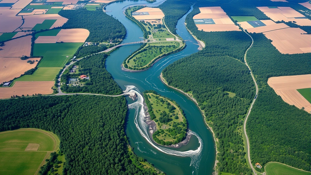
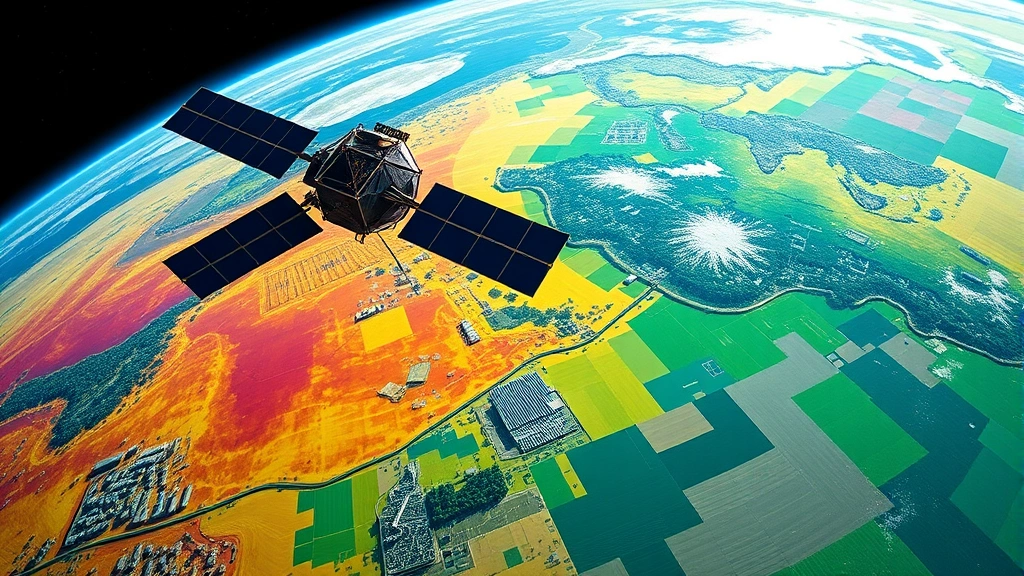
Remote sensing technology—the science of obtaining information about Earth’s surface without physical contact—has evolved from a niche scientific tool into a transformative economic force reshaping industries, policy frameworks, and investment strategies. Satellites, drones, and aerial platforms now capture unprecedented volumes of environmental data, generating insights that drive decisions worth billions of dollars annually. This convergence of technology and environmental science creates profound economic implications that extend far beyond traditional geography and ecology sectors.
The global remote sensing market reached approximately $62 billion in 2023 and continues accelerating, driven by declining hardware costs, artificial intelligence integration, and urgent demands for climate action and resource management. Organizations worldwide increasingly recognize that accurate environmental monitoring directly translates to competitive advantage, regulatory compliance, and risk mitigation. From agricultural optimization to urban planning, from carbon accounting to disaster response, remote sensing of the environment has become essential infrastructure for modern economies.
Remote Sensing Technology: Economic Foundations and Market Drivers
Remote sensing encompasses a sophisticated ecosystem of sensors, platforms, and analytical frameworks that capture environmental data across visible, infrared, microwave, and thermal spectra. The economic value proposition rests on three fundamental pillars: cost reduction relative to traditional ground-based monitoring, comprehensive spatial coverage enabling regional and global analysis, and real-time or near-real-time data delivery supporting dynamic decision-making.
The democratization of remote sensing technology has accelerated dramatically since the 2000s. Early satellite imagery cost thousands of dollars per scene; contemporary platforms like Sentinel-2 and Landsat provide free or low-cost data with 10-30 meter spatial resolution. Commercial providers including Planet Labs, Maxar Technologies, and BlackSky now offer meter-scale or sub-meter imagery at competitive prices, creating competitive dynamics that benefit end-users across sectors. This technological accessibility has sparked innovation in environment and society integration, enabling stakeholders to monitor environmental conditions with unprecedented precision.
Investment in remote sensing infrastructure reflects confidence in long-term economic returns. The European Commission’s Copernicus programme, funded through multiple billion-euro allocations, generates estimated economic benefits exceeding €20 billion annually through improved resource management, disaster response, and climate adaptation. Similar programs in the United States, China, and India demonstrate global recognition that environmental monitoring infrastructure functions as essential public goods generating positive externalities across multiple economic sectors.
Market segmentation reveals concentrated value creation in specific applications. Agriculture represents approximately 35-40% of commercial remote sensing revenue, followed by infrastructure monitoring (20-25%), urban planning (15-20%), and environmental conservation (10-15%). However, emerging applications in carbon accounting, water resource management, and supply chain transparency are expanding rapidly, suggesting market structure shifts toward climate-related services.
Agricultural Transformation and Precision Economics
Agriculture stands as remote sensing’s most economically mature application domain, generating measurable productivity gains and profitability improvements across diverse farming systems. Multispectral satellite imagery enables farmers to monitor crop health through vegetation indices like NDVI (Normalized Difference Vegetation Index), identifying stress patterns invisible to human observation. This capability translates directly to optimized input application—fertilizers, water, pesticides—reducing costs while improving yields.
The economic impact manifests through multiple mechanisms. Precision agriculture powered by remote sensing data reduces input costs by 10-20% through targeted application, decreases environmental externalities from chemical runoff, and increases yields by 5-15% depending on crops and baseline management practices. For global agricultural output valued at approximately $1.3 trillion annually, even modest efficiency improvements represent hundreds of billions in cumulative economic value.
Commercial adoption accelerates through integrated platforms combining remote sensing with agronomic models and farm management systems. Companies like John Deere, AGCO, and emerging agtech startups embed satellite and drone imagery into decision-support tools that farmers access via subscription models. This service-based economics creates recurring revenue streams while aligning farmer incentives with sustainable intensification—producing more with fewer resources.
Developing economies gain particular advantages from remote sensing applications. Smallholder farmers in sub-Saharan Africa and South Asia, who collectively manage over 500 million hectares, increasingly access smartphone-based applications delivering localized crop recommendations derived from satellite data. This democratization of information addresses historical information asymmetries that disadvantaged resource-poor farmers, potentially contributing to poverty reduction alongside environmental improvements.
Water management represents an underutilized but economically significant remote sensing application. Monitoring soil moisture via microwave sensors and thermal imagery enables irrigation optimization, particularly critical in water-stressed regions. Studies from India and the Middle East document 20-30% water savings from irrigation scheduling informed by remote sensing, translating to substantial cost reductions and improved water security in increasingly arid regions.

Climate Finance and Carbon Markets Integration
Remote sensing technology underpins the emerging climate finance infrastructure that channels trillions of dollars toward emissions reduction and climate adaptation. Satellite-based monitoring of forest cover, forest degradation, and land-use change provides the measurement, reporting, and verification (MRV) systems essential for carbon credit markets and climate finance mechanisms. This technical capability enables economic instruments previously impossible to implement at scale.
Deforestation monitoring exemplifies remote sensing’s climate finance role. The European Commission’s Copernicus Land Monitoring Service and NASA’s Global Forest Watch combine multispectral satellite imagery with sophisticated change-detection algorithms to track forest loss with monthly temporal resolution and hectare-level spatial precision. This capability directly supports human environment interaction policies and REDD+ (Reducing Emissions from Deforestation and Forest Degradation) mechanisms, which have mobilized approximately $3.6 billion in climate finance for forest conservation in developing countries.
The World Bank’s Forest Carbon Partnership Facility and similar instruments rely fundamentally on remote sensing-derived baseline data and monitoring systems. Without accurate, independent verification of land-use change, these mechanisms would face insurmountable credibility challenges and pricing uncertainty. Remote sensing essentially commodifies forest conservation, enabling market transactions where none previously existed.
Carbon markets increasingly demand remote sensing capabilities for compliance verification. The World Bank climate finance initiatives and emerging voluntary carbon markets value remote sensing services at $50-200 per hectare for project-level monitoring, depending on required precision and temporal frequency. As carbon prices rise—trading at $50-100+ per metric ton in premium markets—the economic incentive for accurate monitoring strengthens substantially.
Methane emissions monitoring represents an emerging frontier where remote sensing creates new economic value. Satellites equipped with hyperspectral sensors can detect methane plumes from oil and gas infrastructure, creating accountability mechanisms previously absent. This capability supports climate policy enforcement and enables insurance companies and investors to quantify methane-related financial risks, influencing capital allocation decisions across the energy sector.
Urban Development and Real Estate Valuation
Urban areas generate approximately 80% of global GDP despite occupying less than 3% of Earth’s land surface, making urban development economics intensely concentrated and high-value. Remote sensing provides city planners, developers, and investors with comprehensive environmental baselines essential for sustainable urbanization.
Land-use mapping derived from satellite imagery enables cities to quantify sprawl dynamics, identify development constraints from environmental hazards, and optimize infrastructure placement. High-resolution imagery reveals building footprints, roof materials, and vegetation coverage, supporting property valuation models and environmental impact assessments. Real estate companies increasingly integrate satellite-derived data into automated valuation models (AVMs), recognizing that environmental factors—proximity to vegetation, flood risk, urban heat island effects—significantly influence property values.
Urban heat island quantification via thermal remote sensing demonstrates direct economic linkages. Satellite thermal imagery reveals surface temperature variations across cities, with densely built areas frequently 5-10°C warmer than vegetated surroundings. This temperature gradient increases cooling energy demand, reducing building energy efficiency and raising operating costs. Cities including Singapore, Phoenix, and Dubai now use thermal remote sensing to guide green infrastructure investments, recognizing that vegetation and reflective surfaces reduce cooling costs and enhance property values.
Flood risk assessment powered by remote sensing influences insurance pricing, mortgage lending, and property investment decisions across urban real estate markets worth tens of trillions of dollars. Satellite-derived elevation models (DEMs) enable hydrologic modeling with unprecedented accuracy, supporting actuarial models that quantify flood risk at parcel-level precision. This improved risk quantification reduces information asymmetries between buyers and sellers, supporting more efficient property markets.
Supply chain monitoring in urban contexts leverages remote sensing to track construction material sourcing and waste management. Satellite imagery documents quarry expansion, landfill growth, and illegal dumping, creating accountability mechanisms that support environmental regulations and reduce externalities from construction activities.
Disaster Risk Reduction and Economic Resilience
Natural disasters impose annual economic losses exceeding $300 billion globally, with impacts increasingly concentrated among vulnerable populations in developing countries. Remote sensing technology supports disaster risk reduction through three mechanisms: hazard monitoring enabling early warning systems, rapid damage assessment following disasters, and resilience planning informed by historical hazard data.
Hurricane and typhoon monitoring via meteorological satellites provides weeks of advance warning, enabling evacuations and preparation that reduce mortality and morbidity. The economic value of improved early warning extends beyond direct lives saved; it encompasses reduced property damage, minimized business interruption, and preserved economic productivity. Studies from the United Nations Environment Programme estimate that every dollar invested in disaster early warning systems yields $4-7 in avoided losses.
Post-disaster damage assessment represents an increasingly critical application where remote sensing demonstrates unique economic value. Following hurricanes, earthquakes, or floods, satellite imagery enables rapid quantification of infrastructure damage across large areas, supporting insurance claim processing, disaster relief allocation, and reconstruction planning. This capability accelerates economic recovery by reducing uncertainty and enabling swift resource mobilization.
Flood inundation mapping derived from satellite radar (SAR) imagery provides real-time situational awareness during floods, supporting emergency response coordination and resource deployment. The economic value of improved emergency response efficiency—reducing response times and targeting interventions more precisely—compounds across repeated disaster events.
Wildfire monitoring and prediction using remote sensing data supports fire prevention investments and evacuation planning. California’s fire management agencies increasingly integrate satellite-derived vegetation moisture indices with weather forecasts to predict fire risk, enabling proactive fuel reduction investments and community preparation.
Ecosystem Services Valuation and Natural Capital Accounting
Ecosystem services—the benefits humans derive from natural systems including pollination, water purification, climate regulation, and nutrient cycling—remain largely unpriced in conventional economic accounting. Remote sensing enables quantification of ecosystem condition and service provision at scales previously impossible, supporting emerging natural capital accounting frameworks that integrate environmental assets into economic decision-making.
Vegetation mapping and monitoring through multispectral satellite imagery provides fundamental data for ecosystem services valuation. Satellite-derived maps of forest type, forest density, and vegetation health enable modelers to estimate carbon sequestration, water yield, and biodiversity habitat provision. These estimates feed into ecosystem services valuation frameworks, supporting payment for ecosystem services (PES) schemes and natural capital accounting initiatives.
The definition of environment science increasingly incorporates quantitative ecosystem services assessment, enabled fundamentally by remote sensing data. National governments including Costa Rica, Mexico, and several European countries now implement natural capital accounting frameworks that integrate satellite-derived environmental data into national accounting systems alongside conventional GDP measures.
Biodiversity monitoring through remote sensing proxies—vegetation diversity indices, habitat fragmentation metrics derived from satellite imagery—supports conservation planning and natural capital valuation. While satellite imagery cannot directly count species, it quantifies landscape conditions strongly correlated with biodiversity, enabling cost-effective monitoring across vast areas where ground surveys remain prohibitively expensive.
Wetland mapping and monitoring exemplifies remote sensing’s value for ecosystem services quantification. Wetlands provide water purification, flood buffering, carbon storage, and wildlife habitat, yet historically lacked systematic monitoring. Satellite-based wetland mapping now enables countries to quantify wetland extent and condition, supporting conservation priorities and ecosystem services valuation. The economic value of wetland services—estimated at $15,000+ per hectare annually in some contexts—justifies substantial monitoring investments.

Emerging Technologies and Future Economic Opportunities
Artificial intelligence and machine learning integration with remote sensing data represents the frontier of economic value creation. Automated feature extraction from satellite imagery—identifying buildings, roads, agricultural fields, water bodies—previously required expensive manual interpretation. Contemporary deep learning models now perform these tasks with accuracy exceeding human interpreters, reducing processing costs by orders of magnitude while enabling real-time analysis.
Hyperspectral remote sensing, capturing imagery across hundreds of narrow spectral bands, enables applications previously impossible with conventional multispectral sensors. Mineral mapping, crop stress detection at subclinical stages, and water quality assessment all benefit from hyperspectral data. As hyperspectral satellite constellations expand—including missions from Planet Labs and emerging commercial providers—costs decline and accessibility increases, enabling broader economic applications.
Synthetic aperture radar (SAR) satellites provide all-weather, day-night imaging capabilities essential for tropical regions with persistent cloud cover and for monitoring dynamic processes including subsidence, landslides, and ice sheet change. SAR constellation expansion through European, Canadian, and commercial providers creates redundancy and improved temporal frequency, supporting time-critical applications including flood monitoring and infrastructure inspection.
Drone-based remote sensing complements satellite capabilities, offering meter-scale or centimeter-scale spatial resolution for localized applications. Agricultural drones, infrastructure inspection drones, and environmental monitoring drones create service markets worth billions annually, supporting employment in rural areas and providing cost-effective alternatives to satellite imagery for field-scale applications.
Integration of remote sensing with Internet of Things (IoT) sensor networks creates hybrid monitoring systems combining satellite-scale coverage with ground-based precision. Agricultural applications particularly benefit from this integration, where satellite imagery provides field-scale context while soil moisture and weather sensors provide point-scale precision for irrigation management.
Supply chain transparency increasingly leverages remote sensing to verify sustainability claims. Companies tracking deforestation risk in commodity supply chains employ remote sensing services to monitor land-use change in supplier regions, creating accountability mechanisms that influence agricultural practices and land-use decisions across developing countries. This application connects remote sensing directly to consumer preferences and corporate sustainability commitments, creating economic incentives for environmental stewardship.
Water resource management in water-stressed regions represents an expanding economic opportunity. Satellite-based monitoring of groundwater depletion, surface water availability, and snow cover provides critical data for water allocation decisions worth billions annually. Countries including India, Pakistan, and those in the Middle East increasingly rely on remote sensing to inform water policy and investment decisions.
FAQ
What is remote sensing of the environment and how does it differ from traditional monitoring?
Remote sensing acquires information about Earth’s surface from distance, typically using satellites or aircraft equipped with specialized sensors. Unlike traditional ground-based monitoring requiring physical presence and extensive labor, remote sensing enables comprehensive spatial coverage at lower per-unit costs. This technology captures data across electromagnetic spectra invisible to human eyes, revealing patterns in vegetation health, surface temperature, water content, and land-use change that ground surveys cannot detect efficiently.
How much economic value does remote sensing generate annually?
The remote sensing market itself reached approximately $62 billion in 2023, but downstream economic value generated by applications far exceeds this figure. Agricultural productivity improvements alone exceed $100 billion annually, disaster risk reduction generates $50+ billion in avoided losses, and climate finance mechanisms supported by remote sensing verification channel hundreds of billions toward emissions reduction. Total economic value likely exceeds $500 billion annually when accounting for all applications.
Which industries benefit most from remote sensing technology?
Agriculture represents the largest beneficiary (35-40% of commercial remote sensing revenue), followed by infrastructure monitoring, urban planning, and environmental conservation. Emerging applications in carbon accounting, water management, and supply chain transparency are growing rapidly, suggesting market evolution toward climate and sustainability-focused services.
How does remote sensing support climate finance and carbon markets?
Remote sensing provides the measurement, reporting, and verification systems essential for carbon markets. Satellite monitoring of forest cover, forest degradation, and land-use change enables independent verification of emissions reductions, supporting REDD+ mechanisms and voluntary carbon markets. This technical capability enables economic instruments that would otherwise face credibility challenges, directly mobilizing billions in climate finance.
What emerging technologies are enhancing remote sensing’s economic value?
Artificial intelligence and machine learning automate feature extraction from satellite imagery, dramatically reducing processing costs. Hyperspectral and SAR satellite constellations expand application possibilities. Integration with IoT sensor networks creates hybrid systems combining satellite-scale coverage with ground-based precision. Drone-based remote sensing offers cost-effective alternatives for localized applications. These convergent technologies are expanding remote sensing applications and reducing costs, creating new economic opportunities.
How can developing countries leverage remote sensing for economic development?
Developing countries can utilize free or low-cost satellite data (Sentinel, Landsat, Copernicus) to support agricultural productivity, climate adaptation, disaster risk reduction, and natural resource management. Building local capacity in remote sensing analysis through education and training creates employment while supporting environmental management and sustainable development goals. International partnerships and climate finance increasingly support remote sensing infrastructure in developing countries, recognizing its role in climate action and sustainable development.