3D Biomes: Revolutionizing Ecosystem Models
Three-dimensional biome modeling represents a fundamental shift in how scientists understand and predict ecosystem dynamics. Traditional two-dimensional approaches have long constrained our ability to capture the complexity of vertical stratification, microclimatic variation, and species interaction networks that define real-world environments. By incorporating depth, elevation gradients, and volumetric data, 3D biome models enable researchers to simulate ecosystems with unprecedented accuracy, transforming conservation planning, climate impact assessment, and resource management across the globe.
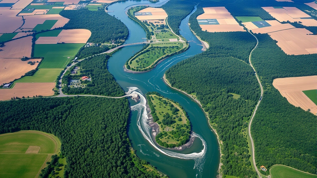
The transition from flat representations to volumetric ecosystem models addresses a critical gap in ecological science. Forests contain distinct vertical layers—canopy, understory, and forest floor—each supporting unique species communities and biogeochemical processes. Marine environments span from sunlit surface waters to deep-sea trenches. Wetlands exhibit complex gradients from aquatic to terrestrial zones. Traditional models collapsed these dimensions into single metrics, losing essential information about ecosystem function and resilience. Three-dimensional biome technology integrates spatial data from remote sensing, field surveys, and computational modeling to create dynamic representations that capture this complexity.
This advancement carries profound implications for environmental economics and policy. Understanding true ecosystem capacity, productivity, and vulnerability requires accurate spatial modeling. Carbon sequestration potential, biodiversity hotspots, and ecosystem service distribution all vary dramatically across three-dimensional space. When policymakers base conservation investments and climate strategies on incomplete models, resources are often misallocated. 3D biome frameworks enable more efficient targeting of interventions, improved cost-benefit analysis of conservation projects, and better prediction of economic impacts from environmental change.

Foundational Technology Behind 3D Biome Modeling
Modern 3D biome modeling relies on converging technologies that were unavailable just a decade ago. Light Detection and Ranging (LiDAR) systems mounted on aircraft and satellites generate precise elevation maps and vegetation structure data at meter-scale resolution. Multispectral and hyperspectral imaging captures vegetation health, species composition, and soil properties across broad geographic areas. Thermal imaging reveals microclimatic conditions that drive species distribution and ecosystem function. These data streams feed into sophisticated computational models that simulate physical processes—solar radiation penetration, water flow, nutrient cycling—across three-dimensional space.
The scientific definition of environment has evolved alongside these technological capabilities. Rather than viewing ecosystems as static collections of species, modern environmental science recognizes them as dynamic, spatially-heterogeneous systems where location, elevation, and depth fundamentally determine ecological processes. 3D biome models operationalize this understanding by creating volumetric representations where every voxel (three-dimensional pixel) contains information about physical conditions, biological communities, and process rates.
Computational power enables real-time simulation of ecosystem processes across these complex spaces. Individual-based models can track thousands of organisms moving through three-dimensional environments. Mechanistic models simulate photosynthesis, respiration, and nutrient uptake at fine spatial resolution. Coupled models integrate atmospheric, hydrological, and biological processes to predict how ecosystems respond to climate variability and human interventions. Machine learning algorithms trained on extensive field data improve predictive accuracy, identifying nonlinear relationships and threshold dynamics that simpler models miss.
Data integration standards have emerged to facilitate 3D biome research. The environment and environmental science definitions now incorporate explicit spatial frameworks. Open-source software platforms allow researchers worldwide to contribute data and access models. Cloud computing infrastructure makes intensive simulations accessible to institutions with limited local resources. This democratization accelerates innovation and enables developing nations to participate in cutting-edge ecosystem research.

Applications in Climate and Conservation
Climate change impacts vary dramatically across three-dimensional space within ecosystems. Mountaintop species face warming that pushes suitable habitat upslope toward disappearing refugia. Forest canopy temperatures may increase 2-3°C more than understory conditions due to differential shading and air circulation. Aquatic systems experience thermally stratified layers where some depths warm while others remain stable. Two-dimensional climate models fail to capture these critical variations, leading to systematic underestimation of climate vulnerability for species and ecosystems occupying specific microhabitats.
3D biome models reveal that climate refugia—areas buffered from extreme warming—are not uniformly distributed. Topographic complexity, vegetation structure, and water bodies create microclimatic oases that may sustain populations as broader regions become inhospitable. Conservation planners can identify these refugia and prioritize protection of habitat corridors connecting them. This spatial precision transforms conservation strategy from coarse-scale reserve designation to targeted landscape design that maximizes ecosystem resilience.
Biodiversity assessment becomes substantially more accurate with volumetric modeling. Species richness in tropical forests concentrates in canopy and mid-story layers, not uniformly across all vertical space. Epiphytic plants, canopy-dwelling arthropods, and canopy-nesting birds represent massive biomass and ecological function entirely invisible in two-dimensional surveys. Wetland systems support different communities at different water depths and soil saturation levels. By quantifying three-dimensional habitat availability, conservation programs can better estimate true biodiversity, identify conservation gaps, and allocate resources to protect underrepresented ecosystems.
Carbon cycling assessment improves substantially through 3D modeling. Aboveground biomass distribution—concentrated in canopy trees—differs fundamentally from soil carbon distribution. Root systems create belowground networks where nutrient and carbon cycling occurs across depths of meters. Soil respiration rates vary with temperature, moisture, and organic matter content in ways that depend critically on depth. Climate change impacts on carbon storage depend on understanding how these vertically-stratified processes respond to warming, precipitation changes, and disturbance. 3D models enable prediction of carbon dynamics with accuracy sufficient for carbon credit markets and climate policy.
Economic Implications and Resource Allocation
Ecosystem services—the benefits humans derive from nature—are inherently three-dimensional phenomena, yet traditional economic valuation treats them as single aggregate values. Water purification capacity depends on aquifer depth, soil layering, and groundwater flow patterns. Flood mitigation depends on floodplain topography and vegetation structure across multiple vertical strata. Pollination services depend on flower distribution across vertical space and bee flight patterns. Carbon sequestration capacity depends on how productively vegetation grows across all layers and how deep soil carbon persists.
When ecosystem service valuations rest on inaccurate spatial models, economic inefficiency follows. Conservation investments may target areas with low actual service provision because two-dimensional models misestimate capacity. Payments for ecosystem services may compensate landowners incorrectly if service flows depend on spatial features the valuation method doesn’t capture. Water resource management may fail if groundwater models don’t account for three-dimensional aquifer structure. Accurate 3D models enable more efficient allocation of conservation funding, more equitable compensation schemes, and more effective resource management.
The economic value of improved prediction is substantial. A landscape covering 10,000 hectares might support conservation investments of $50-500 million. If 3D modeling improves decision-making efficiency by even 10-15%, the economic benefit exceeds the cost of model development by orders of magnitude. For developing nations managing vast ecosystems with limited budgets, this precision becomes transformative. The human environment interaction becomes more economically efficient when spatial understanding improves.
Ecosystem restoration projects benefit from 3D planning frameworks. Restoring degraded forests requires understanding target species’ three-dimensional niche requirements—not just overall climate, but specific conditions at particular heights and depths. Wetland restoration depends on recreating proper water level gradients and soil layering. Coral reef restoration depends on understanding how wave energy varies with depth and how light penetration affects different coral species. 3D models enable restoration design that more reliably achieves ecological and economic objectives.
Market mechanisms for ecosystem services—payments for carbon sequestration, water quality, biodiversity conservation—depend on accurate quantification of service provision. Carbon footprint reduction strategies increasingly rely on natural climate solutions through ecosystem protection and restoration. If carbon accounting underestimates sequestration capacity because spatial distribution isn’t properly quantified, carbon markets misprice credits. If water quality improvements are overestimated because models ignore depth-dependent processes, water funds misdirect investment. 3D biome models provide the spatial precision necessary for well-functioning environmental markets.
Integration with Human Systems
Human economies and ecosystems are fundamentally coupled systems, yet most economic models treat nature as external to economic processes. 3D biome modeling enables more integrated analysis of coupled human-natural systems. Agricultural productivity depends on soil depth, drainage patterns, and microclimate variation—all three-dimensional properties. Urban ecosystem services depend on tree canopy structure, green space distribution, and subsurface hydrology. Fisheries depend on water column stratification, habitat heterogeneity, and vertical migration patterns of prey species.
Urban planning increasingly incorporates ecosystem considerations, but often with insufficient spatial detail. Green infrastructure—green roofs, rain gardens, permeable pavements—provides ecosystem services whose magnitude depends on three-dimensional structure and placement. A rain garden’s water infiltration capacity depends on soil depth and composition. A green roof’s thermal benefits depend on vegetation height and density. Proper sizing and placement of green infrastructure requires understanding how ecosystem processes vary across three-dimensional urban space. Cities using 3D models of their ecosystems can design more effective green infrastructure networks that provide greater services per dollar invested.
Supply chain resilience increasingly depends on ecosystem spatial understanding. Agricultural supply chains depend on soil productivity, water availability, and climate conditions that vary across three-dimensional landscapes. Pharmaceutical and cosmetic companies sourcing natural products from wild plants depend on understanding habitat distribution and productivity. Renewable energy for homes and businesses often integrates with ecosystem management—solar installations on agricultural land, wind farms in grasslands, hydropower in watersheds. Understanding how these land uses interact with ecosystem structure requires three-dimensional spatial models.
Indigenous land management practices often reflect deep understanding of three-dimensional ecosystem structure developed over generations. Traditional forestry systems in tropical regions manage canopy, understory, and ground layers to maximize productivity and resilience. Traditional water management systems in arid regions exploit soil layering and groundwater flow patterns. 3D biome models can quantify the ecosystem outcomes of these practices, demonstrating their ecological efficiency to policymakers and potentially justifying compensation for indigenous stewardship.
Challenges and Future Development
Despite rapid technological progress, significant challenges remain in 3D biome modeling. Data availability remains uneven—wealthy nations have extensive LiDAR coverage and field data, while many developing nations lack basic spatial information about their ecosystems. Computational requirements for detailed 3D models exceed available resources in many institutions. Model validation requires extensive field data that is expensive and time-consuming to collect. Uncertainty quantification in three-dimensional models remains an active research area, with propagation of errors through complex spatial systems still not fully understood.
Standardization of 3D biome modeling approaches would accelerate progress but remains elusive. Different research groups use different data formats, model structures, and validation methods. This heterogeneity impedes comparison of results across studies and prevents efficient knowledge accumulation. International efforts to develop standards are underway, but achieving consensus across disciplines and nations remains challenging. The Ecorise Daily Blog tracks developments in ecosystem science and environmental innovation relevant to these standardization efforts.
Integration of social and economic data into 3D biome models represents a frontier. Ecosystems don’t exist in isolation from human systems—land use, resource extraction, pollution, and management interventions are spatially heterogeneous and interact with ecosystem structure in complex ways. Models that fully couple three-dimensional ecosystem structure with human activities remain rare. Developing such integrated models would enable more realistic assessment of human-ecosystem interactions and more effective design of policies that account for spatial heterogeneity in both ecological and social systems.
Computational efficiency improvements will expand 3D biome modeling accessibility. Current high-resolution models require substantial computing power, limiting their use to well-resourced institutions. Advances in algorithms, hardware, and cloud computing infrastructure will democratize access. Machine learning approaches trained on expensive high-resolution models may enable rapid approximations useful for planning and policy without requiring full computational intensity. Making these tools accessible to conservation organizations and developing nation governments would multiply their impact.
Real-time monitoring and adaptive modeling represent the future frontier. Sensor networks distributed across ecosystems could provide continuous data on three-dimensional environmental conditions. Satellite systems with improved resolution and revisit frequency could track ecosystem changes at finer spatial scales. Models updated continuously with new data would enable adaptive management—adjusting conservation and restoration strategies based on how ecosystems actually respond rather than relying on static predictions. This feedback loop would continuously improve management effectiveness.
FAQ
What specific advantages do 3D biome models provide over traditional two-dimensional approaches?
3D biome models capture vertical stratification and microclimatic variation absent from 2D approaches. They reveal how ecosystem processes—photosynthesis, water cycling, nutrient cycling, species interactions—vary with depth and elevation. This enables more accurate prediction of ecosystem responses to climate change, more precise identification of biodiversity hotspots, and more efficient allocation of conservation resources. For carbon accounting, water quality assessment, and ecosystem service valuation, 3D models provide the spatial precision necessary for accurate quantification.
How do 3D biome models improve conservation planning and resource allocation?
By revealing true ecosystem capacity and spatial distribution of ecosystem services, 3D models enable conservation funding to target areas with greatest impact potential. They identify climate refugia and connectivity requirements for species persistence. They enable ecosystem restoration projects to be designed with greater precision about target conditions. They support payments for ecosystem services by enabling more accurate quantification of service provision. These improvements translate directly to more effective conservation outcomes per dollar invested.
What data sources feed into 3D biome models?
LiDAR provides vegetation structure and topography. Multispectral and hyperspectral satellite imagery reveals vegetation composition and health. Thermal imaging captures microclimate variation. Field surveys provide species occurrence data, biomass measurements, and soil properties. Climate data from weather stations and reanalysis products provide environmental drivers. Historical records document ecosystem changes. All these data streams are integrated through computational models to create dynamic three-dimensional representations of ecosystem structure and function.
How are 3D biome models validated and how reliable are their predictions?
Validation requires comparing model predictions against independent field observations. This is resource-intensive, limiting validation extent in most studies. Sensitivity analysis tests how predictions change with parameter uncertainty. Cross-validation techniques assess prediction accuracy for unobserved locations. Ensemble approaches using multiple models quantify prediction uncertainty. Despite these efforts, prediction reliability remains limited for novel conditions (like unprecedented climate change) and for processes with limited observational data. Ongoing research aims to improve validation methods and uncertainty quantification.
What is the cost of developing and implementing 3D biome models?
Costs vary enormously depending on model complexity, spatial extent, and data requirements. High-resolution models for small areas might cost $50,000-500,000 to develop. Continental or global models cost millions. However, these costs are often justified by the value of improved decision-making. A conservation project benefiting from better spatial targeting might achieve 10-50% greater impact. For large landscapes with substantial conservation investments, improved spatial planning easily justifies model development costs. Open-source tools and data sharing reduce costs for subsequent applications.
How do 3D biome models incorporate climate change projections?
Models integrate climate projections from global circulation models (GCMs) that provide future temperature, precipitation, and other variables. These projections are downscaled to fine spatial resolution using statistical or dynamical methods. The downscaled climate data drives dynamic vegetation models and species distribution models to project how ecosystems will change. Uncertainty in climate projections, model structure, and parameter values is propagated through to create prediction intervals around projections. This enables assessment of ecosystem vulnerability and identification of robust adaptation strategies.