Remote Sensing’s Impact on Economy: Study Insights
Remote sensing technology has fundamentally transformed how we monitor, measure, and manage Earth’s resources. By utilizing satellites, drones, and aerial platforms to collect data about our planet’s surface, remote sensing provides unprecedented insights into environmental changes that directly influence economic outcomes across agriculture, forestry, urban development, and climate adaptation. This technological advancement enables decision-makers to quantify environmental degradation, optimize resource allocation, and implement data-driven policies that balance ecological preservation with economic growth.
The intersection of remote sensing and economic analysis has created a new paradigm in environmental economics. Where traditional field surveys required months or years to assess conditions across large geographic areas, satellite imagery now delivers real-time or near-real-time data covering thousands of square kilometers simultaneously. This capability has profound implications for understanding the true economic costs of environmental change, the valuation of ecosystem services, and the measurement of progress toward sustainable development goals. As economies worldwide grapple with climate change, biodiversity loss, and resource scarcity, remote sensing data has become indispensable for quantifying these challenges and evaluating the effectiveness of policy interventions.
Remote Sensing Technology Fundamentals and Economic Applications
Remote sensing encompasses a diverse array of technologies that capture information about Earth’s features without direct physical contact. These systems operate across multiple electromagnetic wavelengths—visible light, infrared, microwave, and thermal—each revealing different characteristics of land cover, vegetation health, water resources, and atmospheric conditions. The economic significance of this technology lies in its ability to generate spatially explicit, temporally consistent data that quantifies the environment and environmental science principles in measurable, actionable terms.
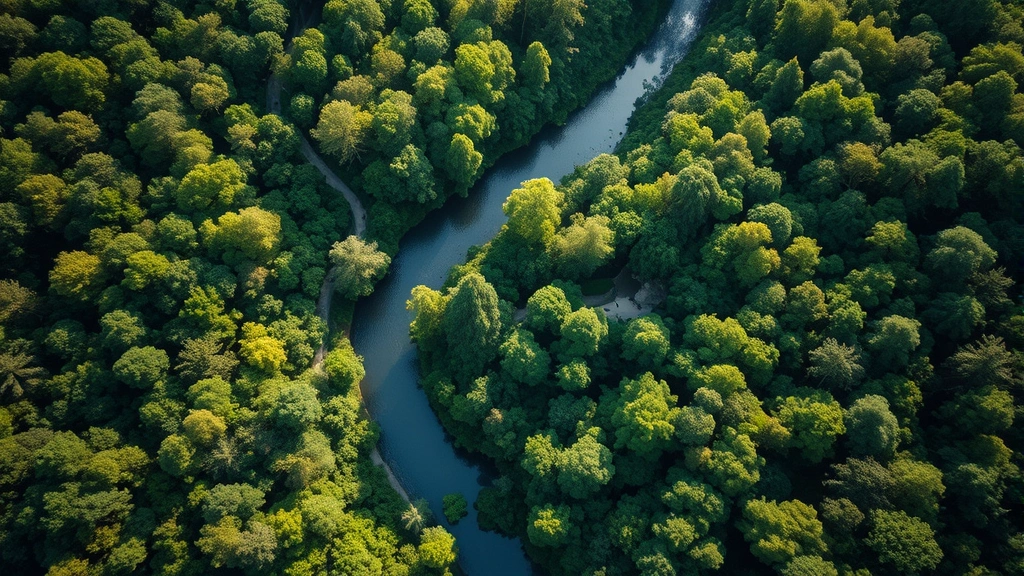
Modern remote sensing platforms range from geostationary satellites providing continuous coverage of specific regions to polar-orbiting satellites capturing global data at various spatial resolutions. Multispectral sensors detect multiple wavelength bands simultaneously, while hyperspectral sensors provide hundreds of spectral bands enabling sophisticated analysis of specific materials and conditions. Synthetic aperture radar (SAR) penetrates cloud cover and darkness, offering all-weather monitoring capabilities essential for tropical regions and high-latitude areas. The economic implications are substantial: a single satellite can monitor agricultural conditions, deforestation rates, urban sprawl, and water availability across entire nations, replacing expensive ground surveys that would require thousands of trained personnel.
The cost-effectiveness of remote sensing has democratized environmental monitoring. A decade ago, satellite imagery was expensive and difficult to access; today, organizations worldwide utilize freely available data from missions like Landsat, Sentinel, and MODIS. This accessibility has enabled developing nations to monitor their natural resources independently, reducing dependence on external consultants and building domestic capacity for environmental management. The economic return on investment in remote sensing infrastructure extends beyond direct monitoring—it enables better-informed decision-making that reduces wasteful spending on failed development projects and optimizes resource allocation toward sustainable outcomes.
Environmental Monitoring as Economic Intelligence
Environmental monitoring through remote sensing functions as economic intelligence, providing quantitative data on the condition and trajectory of natural capital assets. Just as financial analysts monitor stock prices and economic indicators, environmental economists increasingly rely on satellite-derived metrics to assess the health of forests, wetlands, grasslands, and aquatic ecosystems that underpin economic activity. This shift represents a fundamental change in how economies measure wealth and progress.
Remote sensing enables measurement of environmental degradation with unprecedented precision. Land degradation—including soil erosion, salinization, and desertification—directly reduces agricultural productivity and increases production costs. Satellite data quantifies these changes at spatial resolutions of 10-30 meters, allowing economists to correlate degradation patterns with production losses and calculate the true economic costs of poor land management. Studies using remote sensing data have documented that agricultural productivity losses from degradation cost developing economies billions of dollars annually, yet these losses were historically invisible in conventional economic accounting because they occurred gradually across dispersed areas.
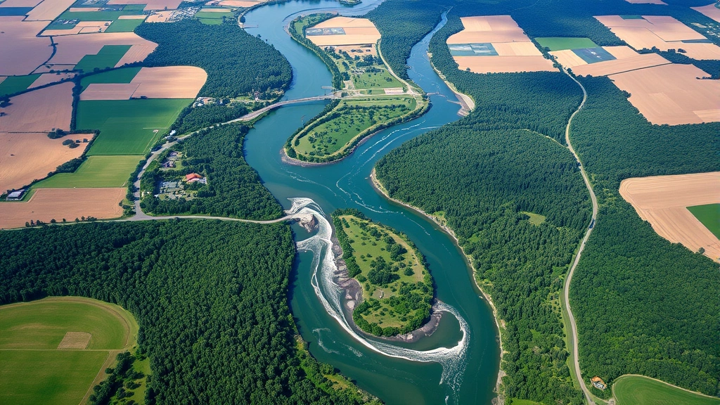
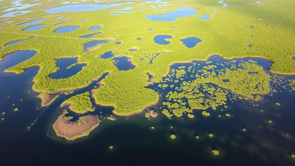
Water resources monitoring represents another critical economic application. Remote sensing measures surface water extent, snowpack accumulation, soil moisture, and groundwater depletion indicators. For economies dependent on irrigation agriculture or hydroelectric power, these measurements directly inform decisions about water allocation, pricing, and investment in water infrastructure. The economic value of improved water management through remote sensing-based monitoring extends from preventing costly droughts that devastate agricultural sectors to optimizing hydroelectric generation and reducing conflicts over transboundary water resources.
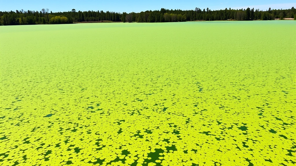
Coastal monitoring via remote sensing has significant economic implications for fishing industries, tourism, and marine ecosystem management. Satellite data tracks chlorophyll concentrations indicating primary productivity, identifies harmful algal blooms that devastate aquaculture, and monitors sea level rise and coastal erosion that threaten infrastructure and settlements. These applications directly support fisheries management, guide investment decisions in coastal tourism, and inform adaptation planning for vulnerable populations.
Agricultural Productivity and Food Security Economics
Agriculture represents the foundation of food security and livelihoods for billions of people, yet agricultural productivity is fundamentally constrained by environmental conditions—precipitation, temperature, soil quality, and pest pressure. Remote sensing provides real-time information on these conditions, enabling farmers, agribusinesses, and policymakers to optimize productivity while managing environmental risks. This capability has profound economic implications for food prices, farmer incomes, and global food security.
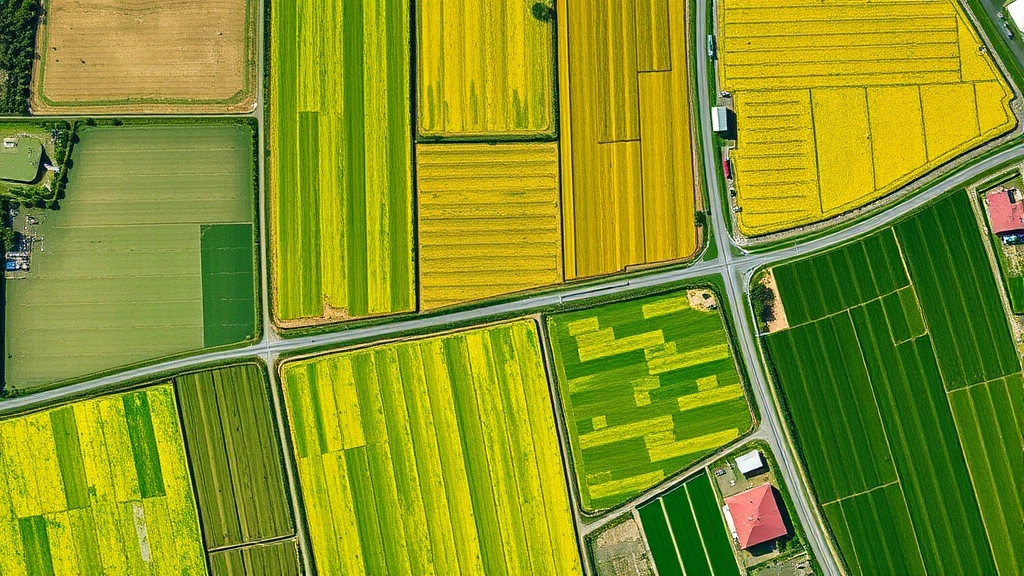
Vegetation indices derived from multispectral satellite data provide quantitative measures of crop health and biomass accumulation. The Normalized Difference Vegetation Index (NDVI) and Enhanced Vegetation Index (EVI) correlate strongly with crop yields, enabling yield prediction months before harvest. This foresight allows commodity markets to adjust prices in advance of supply changes, reducing price volatility that harms both producers and consumers. For developing-country farmers operating on thin profit margins, early warning of poor yields provides crucial time to access credit, diversify income sources, or adjust household expenditures.
Precision agriculture represents the economic frontier of remote sensing application. By mapping spatial variability in soil properties, moisture availability, and pest pressure across fields, remote sensing enables variable-rate application of inputs—seeds, fertilizers, pesticides—matched to specific microenvironments. This approach increases yields while reducing input costs and environmental contamination. Economic analyses demonstrate that precision agriculture increases net farm income by 5-15% while reducing environmental externalities, a win-win outcome that aligns private economic incentives with environmental protection.
Irrigation management constitutes another significant economic application. Remote sensing monitors soil moisture and evapotranspiration, enabling precise determination of irrigation timing and amounts. In water-scarce regions, optimized irrigation increases productivity per unit of water by 10-30%, directly improving farmer profitability while conserving stressed water resources. This application becomes increasingly critical as competition for water intensifies and climate change increases precipitation variability.
Crop insurance and agricultural lending increasingly rely on remote sensing data. Rather than assessing losses through field visits or farmer reports susceptible to fraud, insurers and lenders utilize satellite imagery to objectively verify crop conditions and losses. This transparency reduces moral hazard, lowers insurance costs, and improves credit availability for farmers. Smallholder farmers in developing countries, historically excluded from formal insurance and credit markets, now access these services through remote sensing-based verification systems.
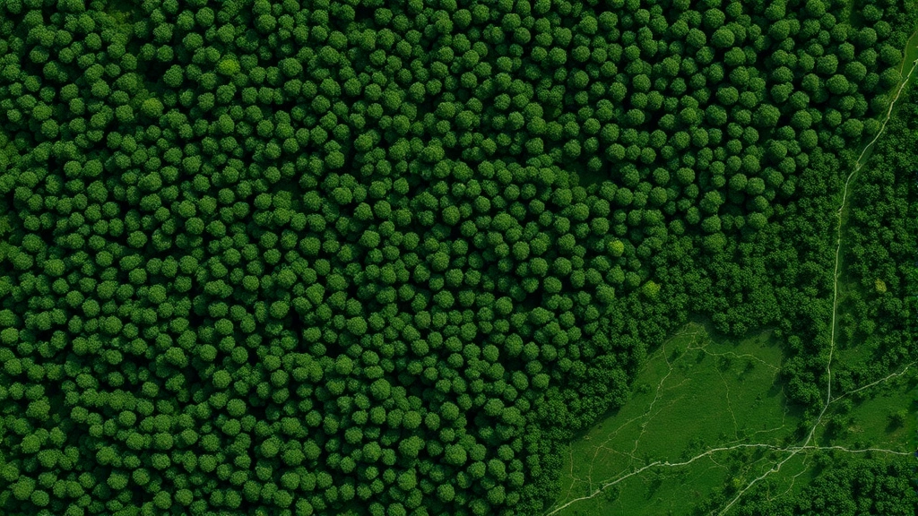
Forest Management and Timber Economics
Forests represent vast economic assets, providing timber, non-timber forest products, carbon storage, and ecosystem services worth trillions of dollars globally. Yet forest management historically relied on ground surveys that captured only small fractions of forest areas, leading to inefficient harvesting, underutilized resources, and unchecked illegal logging. Remote sensing has transformed forest management economics by enabling comprehensive, regular monitoring of forest extent, composition, and health across entire nations.
Deforestation monitoring via satellite imagery directly supports forest conservation economics. The ability to detect and quantify deforestation as it occurs enables rapid response to illegal logging, supports forest certification schemes that command premium prices for sustainably harvested timber, and provides accountability for conservation programs. Research utilizing satellite-detected deforestation data demonstrates that transparent monitoring reduces deforestation rates by 20-30% compared to areas with limited monitoring, indicating that information itself constitutes a valuable economic input.
Timber inventory assessment through remote sensing improves forest economics by enabling accurate estimation of harvestable timber volumes. Multispectral and hyperspectral data, combined with airborne lidar that measures forest structure, provides detailed information on tree species composition, size distributions, and timber quality. This information enables optimal harvest planning that maximizes timber value while maintaining forest sustainability. For developing countries with extensive forest resources but limited technical capacity, remote sensing-based inventory systems represent major improvements over traditional methods.
Carbon accounting in forests increasingly relies on remote sensing-based biomass estimation. Lidar measurements of forest structure combined with ground calibration enable estimation of above-ground biomass with accuracy of 10-15%, sufficient for carbon accounting in forest carbon markets and REDD+ (Reducing Emissions from Deforestation and Degradation) programs. These programs generate economic value from carbon storage, creating financial incentives for forest conservation that compete economically with deforestation for agricultural expansion. The economic viability of forest conservation increasingly depends on accurate, verifiable carbon accounting enabled by remote sensing.
Non-timber forest products—including rubber, palm oil, cocoa, and medicinal plants—also benefit from remote sensing monitoring. Satellite data tracks the distribution and health of these economically important species, supporting sustainable harvest planning and certification schemes that verify environmental compliance and command premium prices in global markets.
Urban Development and Real Estate Valuation
Urban areas concentrate economic activity, population, and wealth, yet urban expansion often occurs haphazardly, destroying agricultural land and natural ecosystems while creating inefficient, unsustainable settlement patterns. Remote sensing provides comprehensive information on urban extent, density, infrastructure development, and environmental conditions that inform urban planning and real estate economics.
Urban growth monitoring through satellite imagery enables quantification of land-use change at spatial and temporal scales impossible with traditional surveys. High-resolution imagery (1-5 meter pixels) reveals individual buildings, roads, and infrastructure, enabling detailed analysis of urban density patterns, informal settlement expansion, and conversion of agricultural or natural land. This information supports urban planning by identifying sprawl patterns, informing infrastructure investment priorities, and evaluating the effectiveness of urban containment policies. Economically, sprawling development increases infrastructure costs, reduces agricultural productivity, and increases transportation expenses, while compact development reduces costs and increases economic efficiency.
Real estate valuation increasingly incorporates remote sensing data on environmental conditions. Proximity to green space, flood risk, air quality, and climate hazards significantly influence property values. Remote sensing enables objective assessment of these characteristics across large areas, improving real estate market transparency and efficiency. Valuation models incorporating satellite-derived environmental data demonstrate better predictive accuracy than traditional models, suggesting that real estate markets are increasingly pricing environmental amenities and hazards as these become more transparent and quantifiable.
Infrastructure planning and maintenance utilize remote sensing for cost optimization. Roads, power lines, water systems, and other infrastructure are monitored via satellite to detect damage, plan maintenance, and optimize service delivery. This application is particularly valuable in developing countries with limited resources for infrastructure inspection and maintenance.
Climate Risk Assessment and Financial Markets
Climate change represents an existential risk to global economic systems, yet quantifying climate impacts on economic assets has proven difficult due to the complexity of climate-economy interactions and the long timescales involved. Remote sensing provides crucial data on climate-related changes—temperature, precipitation, snow cover, vegetation patterns, sea level, coastal erosion—that enable financial markets and investors to assess climate risks and allocate capital appropriately.
Insurance and financial institutions increasingly rely on remote sensing data to assess climate and environmental risks. Flood risk models incorporate satellite-derived information on precipitation, topography, and land cover. Drought risk assessment utilizes satellite-based soil moisture and vegetation monitoring. Coastal risk assessment combines satellite-measured sea level rise with high-resolution topography. These applications enable more accurate risk pricing, reducing the likelihood of catastrophic losses from underestimated risks while avoiding excessive risk premiums that impede investment in affected regions.
Climate adaptation planning depends on remote sensing data characterizing current conditions and recent trends. Farmers deciding whether to shift crop varieties, agricultural regions planning water infrastructure investments, and coastal communities planning retreat or defense strategies all require detailed information on climate patterns and trajectories. Remote sensing provides this information with spatial detail and temporal consistency unavailable from conventional weather stations, enabling locally-specific adaptation planning.
The emerging field of climate finance increasingly utilizes remote sensing for verification and impact assessment. International climate funding for adaptation and mitigation requires mechanisms to verify that resources achieve intended outcomes. Remote sensing enables verification of reforestation projects, renewable energy deployment, agricultural productivity improvements, and ecosystem restoration without expensive ground verification. This capability reduces transaction costs in climate finance, increasing the proportion of funding that reaches beneficiaries rather than being consumed in verification and monitoring.
Ecosystem Services Quantification and Valuation
Ecosystems provide services—pollination, water purification, flood mitigation, climate regulation, cultural values—that underpin economic activity yet remain largely unpriced in markets. Remote sensing enables quantification of ecosystem services at spatial scales matching policy and management jurisdictions, supporting economic valuation and integration of ecosystem service values into decision-making.
Wetland mapping and monitoring via remote sensing reveals the extent of these economically valuable ecosystems. Wetlands provide water filtration, flood buffering, fisheries habitat, and carbon storage worth thousands of dollars per hectare annually in ecosystem services. Yet wetlands have been extensively drained for agriculture, often destroying service value far exceeding the value of agricultural conversion. Remote sensing enables assessment of remaining wetlands, monitoring of wetland degradation, and quantification of ecosystem service losses from conversion, informing policy decisions about wetland protection.
Pollination services from wild bees and other insects depend on habitat availability. Remote sensing maps natural and semi-natural habitat that provides food and nesting sites for pollinators. By relating pollinator habitat distribution to agricultural productivity, economists can quantify the economic value of pollinator habitat and justify conservation investments. Studies combining remote sensing habitat mapping with agricultural economic data demonstrate that pollination services from wild insects are worth billions of dollars annually in global agriculture, far exceeding the cost of habitat conservation.
Carbon sequestration in forests and other ecosystems represents an ecosystem service with growing economic value as carbon markets develop. Remote sensing-based biomass estimation enables measurement of carbon stocks and sequestration rates, supporting carbon accounting and valuation. The economic value of carbon sequestration creates financial incentives for forest conservation and reforestation that can compete with land-use alternatives, though actual carbon prices often remain too low to motivate large-scale conservation in developing countries.
Water supply protection in forested watersheds represents another ecosystem service quantifiable through remote sensing. Forest cover maps derived from satellite imagery correlate with water quality and quantity metrics, enabling valuation of forest protection in terms of water supply benefits. Cities worldwide increasingly invest in protecting forested watersheds as a cost-effective alternative to water treatment infrastructure, decisions informed by remote sensing assessments of forest-water relationships.
Policy Implementation and Cost-Benefit Analysis
Environmental policies frequently fail to achieve intended outcomes due to inadequate monitoring, enforcement, and adaptive management. Remote sensing addresses these challenges by enabling continuous, objective monitoring of policy implementation and outcomes across large geographic areas. This capability fundamentally improves policy effectiveness and economic efficiency.
Protected area management represents a critical application. National parks, wildlife reserves, and conservation areas are established to protect biodiversity and ecosystem services, yet enforcement is often weak, particularly in developing countries with limited resources. Remote sensing enables detection of illegal logging, poaching, and land-use conversion within protected areas. Studies demonstrate that remote sensing-based monitoring increases enforcement effectiveness and reduces illegal activities by 20-40%, protecting economic assets in the form of ecosystem services and wildlife populations.
Environmental regulation compliance monitoring utilizes remote sensing to track adherence to regulations governing land use, water quality, and industrial emissions. Industrial facilities are monitored for thermal pollution and chemical discharge indicators visible in satellite data. Agricultural areas are monitored for compliance with conservation regulations protecting riparian buffers and wetlands. This monitoring capability increases regulatory compliance, as violators know their activities are visible to authorities, improving environmental outcomes without expensive ground-based enforcement.
Disaster response and recovery planning rely heavily on remote sensing. Floods, earthquakes, hurricanes, and other disasters generate satellite imagery showing damage extent and distribution, enabling rapid assessment of needs and efficient allocation of emergency resources. Post-disaster, satellite imagery monitors reconstruction progress and identifies areas requiring additional assistance. These applications save lives and reduce economic losses from disasters through improved emergency response.
Adaptive management—adjusting policies and practices based on monitoring of outcomes—depends on timely information on environmental and economic conditions. Remote sensing provides this information, enabling managers to detect when conditions diverge from expectations and adjust strategies accordingly. This capability is particularly valuable in addressing complex, dynamic environmental challenges like invasive species management, where rapid response to early detection prevents catastrophic ecosystem and economic impacts.
International environmental agreements including the Convention on Biological Diversity, the Ramsar Convention on Wetlands, and the UN Framework Convention on Climate Change increasingly rely on remote sensing data for monitoring progress toward targets and verifying implementation of commitments. This transparency supports accountability and enables identification of countries and regions requiring additional support for implementation.
FAQ
How does remote sensing improve agricultural economics?
Remote sensing provides real-time data on crop health, soil moisture, and pest pressure, enabling farmers to optimize input application, predict yields months ahead of harvest, and reduce production costs by 5-15%. This technology supports precision agriculture that increases profitability while reducing environmental impacts, and enables smallholder farmers to access crop insurance and credit markets through objective verification of crop conditions.
What role does remote sensing play in climate adaptation?
Remote sensing monitors climate-related environmental changes including precipitation patterns, temperature trends, vegetation shifts, and water availability. This information enables communities to plan locally-specific adaptation strategies, informs climate finance allocation, and supports financial risk assessment. The technology provides early warning of climate impacts, allowing time for proactive adaptation rather than reactive crisis response.
How does remote sensing support forest conservation economics?
Satellite-based deforestation monitoring enables rapid detection of illegal logging and enforcement of conservation regulations, reducing deforestation by 20-30% in monitored areas. Remote sensing also enables forest carbon accounting supporting carbon markets and REDD+ programs, timber inventory assessment optimizing harvest planning, and monitoring of non-timber forest products. These applications create economic value from forest conservation that competes with deforestation for agricultural expansion.
What are the cost implications of remote sensing versus traditional environmental monitoring?
A single satellite can monitor environmental conditions across entire nations at lower cost than ground surveys covering equivalent areas. Freely available satellite data from missions like Landsat and Sentinel has democratized environmental monitoring, enabling developing countries to reduce dependence on expensive external consultants. While initial remote sensing infrastructure requires investment, long-term monitoring costs are substantially lower than traditional methods, providing excellent return on investment through improved decision-making.
How does remote sensing enhance ecosystem services valuation?
Remote sensing maps the extent and condition of ecosystems providing valuable services—wetlands for water filtration, forests for pollination support and carbon storage, riparian buffers for water quality protection. By quantifying ecosystem extent and condition across large areas, remote sensing enables economists to value ecosystem services and incorporate these values into policy decisions. This capability supports conservation investments by demonstrating that ecosystem service values often exceed values of alternative land uses.
What limitations exist in remote sensing-based environmental monitoring?
Cloud cover limits optical satellite observations in tropical regions, though radar systems penetrate clouds. Spatial resolution limitations prevent detection of small-scale activities in some applications. Temporal resolution may be insufficient for rapidly changing phenomena. Satellite data requires ground calibration for accurate interpretation. Despite these limitations, remote sensing provides unprecedented capabilities for large-scale environmental monitoring that complement rather than replace ground-based observations.
Remote sensing technology represents a transformative tool for understanding and managing the human environment interaction and the physical environment in economically rational ways. By making environmental conditions transparent and measurable, remote sensing enables markets and policymakers to incorporate environmental considerations into economic decisions, supporting the transition toward sustainable development that balances economic growth with environmental protection. As remote sensing capabilities continue to advance and data accessibility increases, this technology will play an increasingly central role in achieving the sustainable development goals and building resilient, prosperous economies within planetary boundaries.