Remote Sensing’s Role in Economy: Expert Insights into Environmental Monitoring and Economic Decision-Making
Remote sensing technology has fundamentally transformed how we understand and manage our planet’s resources. By capturing detailed environmental data from satellites and aerial platforms, this technology provides unprecedented insights into land use patterns, agricultural productivity, forest health, and water resources. These measurements directly influence economic decisions across industries, from agriculture and forestry to urban planning and climate finance. The convergence of remote sensing capabilities with economic analysis creates a powerful framework for sustainable development and resource optimization.
The economic implications of remote sensing extend far beyond simple data collection. When governments and corporations access real-time information about environmental conditions, they can make more informed investment decisions, reduce operational risks, and identify emerging market opportunities. This article explores how remote sensing technology shapes modern economies, the mechanisms through which environmental monitoring drives economic value, and expert perspectives on future applications in sustainable finance and natural resource management.
Understanding Remote Sensing Technology and Environmental Monitoring
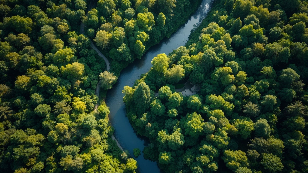
Remote sensing represents a paradigm shift in how we collect environmental data. Rather than relying on ground surveys and manual assessments, satellites equipped with multispectral and hyperspectral sensors capture information across electromagnetic wavelengths, revealing patterns invisible to the human eye. This technology enables monitoring of vegetation health, soil moisture, water temperature, atmospheric composition, and land surface changes at scales ranging from individual farm fields to entire continents.
The economic significance of this capability cannot be overstated. Traditional environmental monitoring required expensive field teams, time-consuming data collection, and delayed information availability. Remote sensing compresses these timelines from months to days or even hours, allowing decision-makers to respond quickly to environmental changes. A farmer can assess crop stress across thousands of acres in minutes; a financial analyst can track deforestation in real-time to evaluate investment risks; a government agency can monitor water quality changes that affect public health and economic productivity.
The technical infrastructure supporting remote sensing has become increasingly sophisticated. Modern satellite constellations provide daily or even sub-daily coverage of most terrestrial surfaces, with spatial resolutions ranging from 30 meters for broad regional assessments to sub-meter precision for detailed local analysis. This technological maturation has democratized access to environmental information, reducing costs and enabling participation from developing nations and small enterprises previously locked out of sophisticated monitoring systems.
Understanding the human environment interaction through remote sensing reveals complex feedback loops between economic activities and ecological systems. Industrial expansion, agricultural intensification, and urban sprawl create measurable signatures in satellite imagery, allowing economists and policymakers to quantify the environmental costs of growth and identify more sustainable pathways forward.
Economic Applications in Agriculture and Land Management
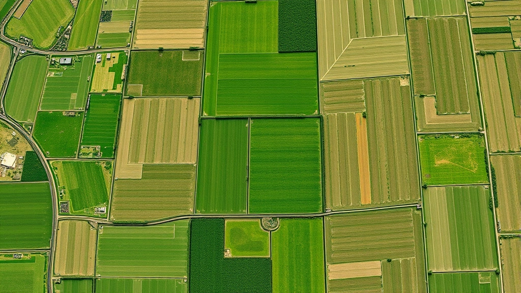
Agriculture represents one of the most significant economic sectors worldwide, and remote sensing has revolutionized how this industry operates. Precision agriculture—the practice of tailoring farming inputs to specific field conditions—depends fundamentally on satellite and aerial imagery. Farmers can now identify which portions of their fields suffer from water stress, nutrient deficiencies, or pest pressure, then apply fertilizers, pesticides, and water precisely where needed.
This precision translates directly into economic benefits. Studies consistently demonstrate that farms using remote sensing-based decision support systems achieve 10-20% improvements in input efficiency, reducing costs while maintaining or increasing yields. For a 1,000-hectare operation, such improvements can mean thousands of dollars in annual savings. Scaled globally across billions of hectares of agricultural land, the economic impact reaches hundreds of billions of dollars annually.
Remote sensing also enables better crop forecasting and market planning. By monitoring vegetation indices across growing regions, analysts can predict harvest sizes weeks or months in advance, allowing commodity traders, processors, and retailers to plan inventory and pricing strategies more effectively. This reduces market volatility and improves supply chain efficiency throughout the food system.
Land management extends beyond active agriculture. Remote sensing helps identify degraded lands suitable for restoration, track the success of reforestation projects, and monitor invasive species expansion. These applications have significant economic consequences for property values, insurance costs, and long-term land productivity. The ability to quickly assess land condition enables more sophisticated real estate markets and more accurate environmental impact assessments for development projects.
Learn more about how monitoring practices support living environment quality and economic sustainability through integrated resource management approaches.
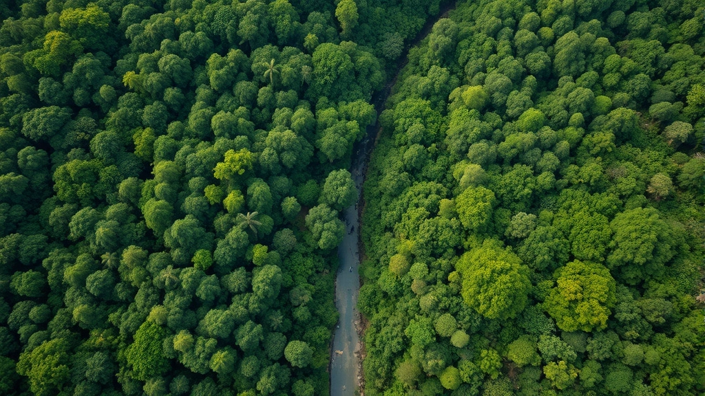
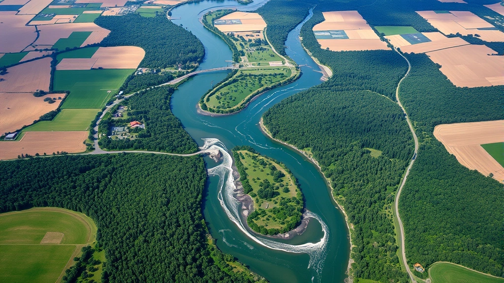
Forest Monitoring and Ecosystem Services Valuation
Forests provide enormous economic value through timber production, carbon sequestration, water purification, biodiversity support, and cultural services. Remote sensing enables quantification of these values with unprecedented accuracy. Satellite imagery reveals forest structure, biomass distribution, and changes over time, creating the foundation for sophisticated ecosystem services valuation frameworks.
The carbon economy particularly benefits from remote sensing capabilities. As carbon markets expand and climate finance grows, the ability to accurately measure forest carbon stocks and changes becomes critical for investment decisions. Remote sensing provides the transparency and objectivity that carbon credit buyers demand, reducing transaction costs and enabling broader participation in climate mitigation finance. The World Bank’s climate change initiatives increasingly rely on remote sensing data to track progress toward emission reduction targets and ecosystem protection goals.
Illegal logging detection represents another significant economic application. By monitoring forest cover changes in near real-time, governments and conservation organizations can identify unauthorized timber harvesting and respond quickly to prevent losses. In regions where illegal logging costs governments billions in lost revenue, remote sensing provides a cost-effective enforcement tool that increases the risks and reduces the profitability of illegal operations.
Forest degradation monitoring—tracking changes in forest quality short of complete clearance—reveals economic impacts often invisible in traditional monitoring systems. Selective logging, fuel wood extraction, and grazing create measurable changes in vegetation structure detectable through remote sensing analysis. Quantifying these changes enables more accurate assessment of forest condition and more appropriate economic valuations for conservation finance and sustainable use programs.
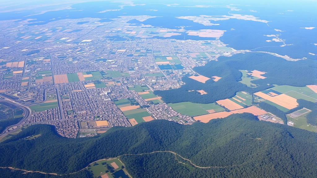
Urban Development and Infrastructure Planning
Cities concentrate economic activity and consume resources at unprecedented rates. Remote sensing provides crucial information for urban planners, infrastructure investors, and municipal administrators seeking to optimize development patterns and service delivery. Satellite imagery reveals urban expansion rates, identifies areas of informal settlement requiring targeted investment, and tracks changes in building density and land use composition.
Infrastructure planning depends increasingly on remote sensing data. Utilities can use satellite imagery to plan electricity distribution networks, water supply systems, and transportation corridors more efficiently. Real estate developers employ remote sensing to assess site conditions, identify suitable development areas, and understand competitive landscapes. Insurance companies use this technology to assess exposure to flood risk, heat stress, and other climate-related hazards in urban areas.
The economic efficiency gains from better urban planning extend throughout municipal operations. Cities that use remote sensing to optimize traffic flow, reduce water loss in distribution systems, or improve emergency response planning realize significant cost savings. These savings can be reinvested in services, reducing fiscal pressure on municipal budgets and improving quality of life for residents.
Understanding the broader environmental and economic trends affecting urban areas helps planners anticipate future challenges and opportunities. Remote sensing reveals how cities interact with surrounding agricultural areas, forests, and water systems, enabling integrated planning that accounts for ecosystem services and natural capital considerations.
Climate Finance and Carbon Credit Markets
The emergence of carbon markets and climate finance mechanisms has created new economic value streams dependent on accurate environmental monitoring. Remote sensing provides the foundation for measuring, reporting, and verifying emissions reductions and carbon sequestration—the fundamental requirement for carbon credit issuance and climate finance disbursement.
REDD+ (Reducing Emissions from Deforestation and Degradation) programs exemplify this application. By using remote sensing to measure baseline forest cover and track changes over time, these programs create financial incentives for forest conservation in developing countries. Billions of dollars flow through REDD+ mechanisms, with remote sensing providing the measurement rigor that international buyers and carbon credit traders demand. The United Nations Environment Programme has emphasized remote sensing’s critical role in climate action and sustainable development monitoring.
Emerging corporate sustainability commitments increasingly depend on remote sensing verification. Companies pledging to eliminate deforestation from supply chains employ satellite monitoring to verify supplier compliance and identify risk areas requiring intervention. This creates market incentives for sustainable land management and enables more sophisticated due diligence in commodity supply chains.
The economic dynamics of climate finance create strong incentives for remote sensing innovation and improved accuracy. As carbon prices increase and climate finance volumes grow, the value of more precise measurement systems increases proportionally. This drives continuous improvement in satellite technology, data processing algorithms, and analytical methods, creating a virtuous cycle of innovation and capability enhancement.
Water Resources Management and Economic Efficiency
Water represents a critical economic input for agriculture, industry, and municipal services, yet many regions face increasing scarcity. Remote sensing enables sophisticated water resource monitoring that improves allocation efficiency and reduces waste. Satellite imagery reveals groundwater conditions through subtle vegetation and soil moisture signals, helping water managers identify sustainable extraction rates and plan infrastructure investments.
Irrigation efficiency improvements driven by remote sensing data can be transformative for agricultural economies. In water-scarce regions, precision irrigation systems guided by satellite soil moisture estimates increase crop yields per unit of water by 20-40%, dramatically improving farm profitability while stretching limited water supplies. At regional scales, these improvements can mean the difference between agricultural sustainability and collapse.
Hydropower operations benefit from remote sensing monitoring of precipitation patterns, snowpack extent, and reservoir levels. By optimizing water release timing based on better weather forecasting and hydrological monitoring, operators can improve energy generation efficiency and reduce costs while maintaining environmental flows. This illustrates how environmental monitoring serves economic optimization across multiple objectives.
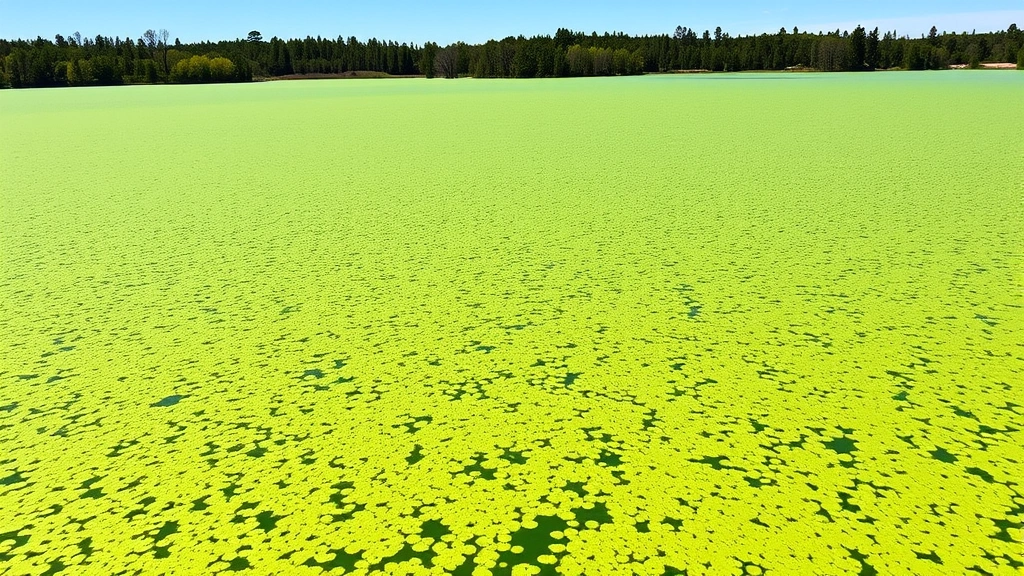
Water quality monitoring through remote sensing reveals pollution sources and ecosystem stress, enabling more targeted and cost-effective remediation efforts. Algal blooms, sediment plumes, and thermal pollution become visible in satellite data, allowing rapid response to emerging problems before they cause major economic losses in fisheries, tourism, or water supply sectors.
Risk Assessment and Disaster Economics
Natural disasters impose enormous economic costs—the World Bank estimates annual disaster losses at hundreds of billions of dollars—and remote sensing improves disaster prediction, preparedness, and response. Satellite monitoring of weather patterns, volcanic activity, sea surface temperatures, and other disaster precursors enables earlier warnings that save lives and reduce economic damage.
Insurance and financial risk assessment increasingly incorporates remote sensing data. Insurers use satellite imagery to assess property risk, monitor environmental conditions affecting claims frequency, and price policies more accurately. This creates more efficient insurance markets where risk-appropriate premiums encourage loss prevention while enabling broader insurance availability.
Post-disaster assessment and recovery planning depend critically on remote sensing. After floods, earthquakes, or hurricanes, satellite imagery provides rapid damage assessment that guides emergency response allocation and recovery planning. This capability dramatically reduces recovery time and improves targeting of limited relief resources to areas of greatest need.
The relationship between reducing environmental stress and improving resilience to natural disasters appears clearly in remote sensing data. Regions maintaining healthy forests, wetlands, and other natural systems show reduced disaster impacts, demonstrating the economic value of ecosystem conservation as disaster risk reduction investment.
Future Trends and Expert Recommendations
Remote sensing technology continues advancing rapidly, with emerging capabilities promising even greater economic applications. Hyperspectral sensors can identify specific chemical compounds in vegetation and soil, enabling detection of plant diseases, nutrient status, and contamination before visible symptoms appear. This precision supports increasingly sophisticated agricultural optimization and environmental quality monitoring.
Artificial intelligence and machine learning applied to remote sensing data reveal patterns invisible through traditional analysis. Neural networks trained on historical imagery can predict crop yields with remarkable accuracy, identify emerging environmental problems, and optimize resource allocation across complex systems. These applications drive economic value by enabling more precise forecasting and decision-making.
Data democratization represents another crucial trend. As satellite data becomes increasingly available and processing tools become more accessible, smaller enterprises and developing-country organizations gain capabilities previously limited to well-resourced corporations and governments. This democratization should accelerate innovation in remote sensing applications and broaden the distribution of economic benefits.
Expert consensus emphasizes integrating remote sensing with other data sources—ground measurements, economic statistics, social data—to create comprehensive monitoring systems. Remote sensing alone provides incomplete information; combined with contextual data, it becomes a powerful decision-support tool. Future economic applications will likely emphasize these integrated approaches.
The ecological economics research community increasingly recognizes remote sensing as fundamental to understanding natural capital and ecosystem services. As environmental accounting frameworks become more sophisticated, remote sensing provides the measurement foundation these systems require, enabling more accurate assessment of true economic costs and benefits of different development pathways.
Investment in remote sensing infrastructure should be viewed as critical development and sustainability investment. Nations and organizations lacking sophisticated environmental monitoring capacity face significant disadvantages in climate negotiations, carbon finance access, and sustainable resource management. Building local remote sensing capabilities supports long-term economic resilience and enables more autonomous decision-making based on local environmental conditions.
Explore how renewable energy transitions and sustainable economic practices benefit from improved environmental monitoring and data-driven decision-making frameworks supported by remote sensing technology.
FAQ
How does remote sensing improve agricultural productivity and reduce costs?
Remote sensing enables precision agriculture by identifying field-level variations in soil moisture, nutrient status, and pest pressure. Farmers can apply inputs only where needed, reducing waste and improving yields. Studies show 10-20% improvements in input efficiency, translating to thousands of dollars in annual savings for large operations.
What role does remote sensing play in carbon credit markets and climate finance?
Remote sensing provides the measurement rigor required for carbon credit verification. By accurately tracking forest cover changes and carbon stock variations, it enables REDD+ programs and other climate finance mechanisms that compensate developing countries for conservation efforts. This creates multi-billion-dollar economic incentives for sustainable land management.
How can remote sensing help detect and prevent illegal logging?
Satellite imagery reveals unauthorized forest clearing in near real-time. Governments can respond quickly to stop illegal logging, reducing losses and increasing enforcement effectiveness. This capability makes illegal logging riskier and less profitable, creating economic incentives for legal timber production.
What economic benefits does remote sensing provide for urban planning and infrastructure?
Remote sensing reveals urban expansion patterns, identifies optimal infrastructure locations, and helps plan efficient service delivery. Cities using this technology optimize traffic flow, reduce water loss, and improve emergency response, realizing significant cost savings and service quality improvements.
How is artificial intelligence enhancing remote sensing applications?
Machine learning algorithms applied to satellite imagery identify complex patterns and enable precise forecasting. AI can predict crop yields, identify emerging environmental problems, and optimize resource allocation more accurately than traditional analysis, driving economic value through better decision-making.
What are the barriers to remote sensing adoption in developing countries?
Key barriers include limited technical capacity, insufficient funding for infrastructure, and lack of institutional integration of satellite data into decision-making processes. Addressing these barriers requires capacity building, accessible data provision, and institutional support for technology adoption.