Remote Sensing: Boosting Ecosystem Insights Through Advanced Technology
Remote sensing has revolutionized our ability to monitor, measure, and understand Earth’s ecosystems at unprecedented scales and resolutions. By capturing electromagnetic radiation reflected or emitted from landscapes without direct contact, remote sensing technologies provide critical data for environmental management, conservation planning, and ecosystem assessment. This technological advancement enables scientists, policymakers, and environmental managers to track changes in real-time, detect anomalies, and make informed decisions about resource allocation and ecological protection.
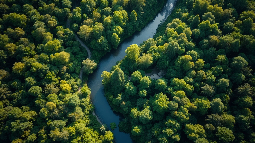
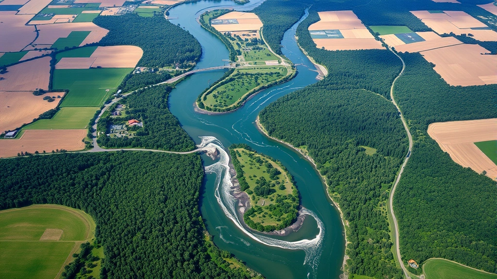
The intersection of remote sensing and environmental science represents one of the most significant advances in our capacity to understand planetary systems. From monitoring deforestation rates to tracking water quality changes, detecting agricultural productivity shifts to identifying biodiversity hotspots, remote sensing instruments deployed on satellites and aircraft generate terabytes of data annually. These datasets fuel our understanding of ecosystem dynamics, human-environment interactions, and the physical environment that sustains all life.

Understanding Remote Sensing Technology
Remote sensing encompasses a diverse array of technological platforms and sensors that capture information about Earth’s surface and atmosphere. The fundamental principle involves measuring electromagnetic radiation across multiple wavelengths—from visible light through infrared to microwave frequencies. Different materials and biological features exhibit unique spectral signatures, allowing analysts to classify and quantify ecosystem components with remarkable precision.
Satellite-based remote sensing systems include multispectral sensors like Landsat and Sentinel, which capture data across several distinct wavelength bands, and hyperspectral sensors that measure hundreds of narrow bands simultaneously. These platforms orbit Earth at varying altitudes, with temporal resolutions ranging from daily to monthly revisit cycles. Additionally, Unmanned Aerial Vehicles (UAVs) equipped with advanced sensors provide high-resolution data for localized ecosystem assessments, while airborne platforms enable targeted surveys of specific regions.
The relationship between environmental science and remote sensing technology has become increasingly symbiotic. Environmental scientists rely on remote sensing to validate field observations, extend spatial coverage, and create temporal datasets spanning decades. This technological capacity fundamentally transforms how we measure and understand the physical environment, enabling ecosystem insights previously impossible to obtain through conventional methods alone.
Sensor technology continues advancing rapidly. Modern systems achieve spatial resolutions below one meter, temporal resolutions approaching real-time, and spectral sophistication capable of detecting subtle biochemical changes in vegetation. These improvements expand the scope of ecosystem monitoring, from landscape-scale assessments to individual organism-level detection in certain applications.
Spectral Analysis and Ecosystem Monitoring
Spectral analysis forms the analytical backbone of remote sensing applications in ecosystem monitoring. Plants, water bodies, soil types, and urban infrastructure each exhibit distinctive spectral signatures—the pattern of electromagnetic radiation they reflect or absorb across different wavelengths. By analyzing these signatures, analysts can classify land cover, assess vegetation health, and detect environmental changes with quantifiable accuracy.
The Normalized Difference Vegetation Index (NDVI) represents perhaps the most widely utilized spectral metric in ecosystem science. This index calculates the difference between near-infrared and red light reflectance, producing values that correlate strongly with vegetation biomass, photosynthetic activity, and ecosystem productivity. Temporal NDVI datasets spanning 40+ years enable researchers to document long-term vegetation trends, identify degradation patterns, and quantify the impacts of climate variability on ecosystems.
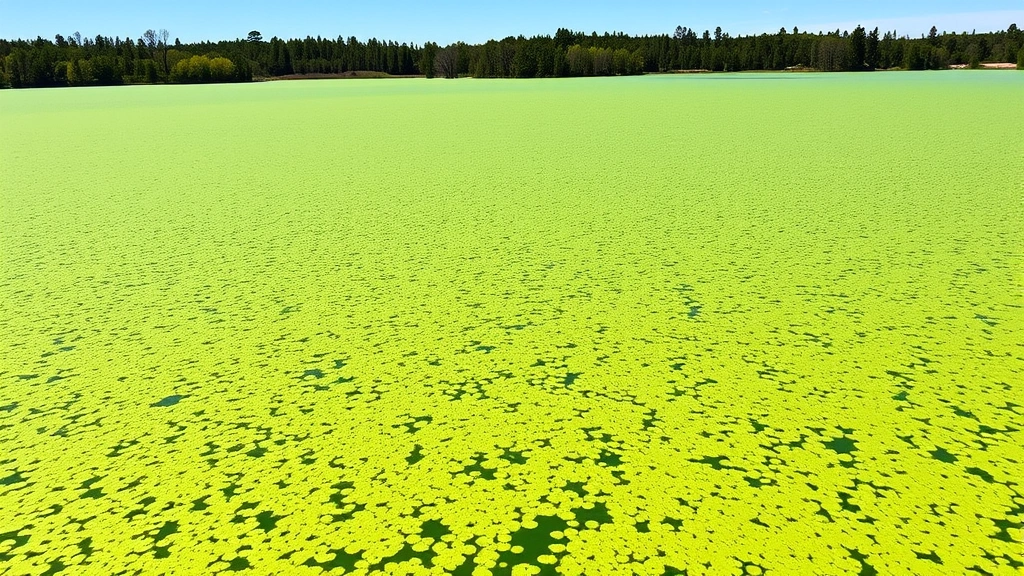
Water indices employ similar spectral logic, measuring specific wavelength combinations to detect water presence, assess water quality parameters, and monitor wetland extent. Enhanced Vegetation Index (EVI) and Modified Normalized Difference Water Index (MNDWI) represent sophisticated variants that correct for atmospheric effects and improve accuracy in complex environments. These analytical approaches transform raw spectral data into ecologically meaningful metrics, bridging the gap between technological capability and environmental understanding.
Temporal analysis of spectral data reveals ecosystem dynamics across seasons and years. Phenological monitoring—tracking the timing of seasonal events like leaf emergence, flowering, and senescence—provides insights into climate change impacts on species and communities. Remote sensing data demonstrates that spring phenology has advanced by 2-3 days per decade in many temperate regions, with cascading implications for food web synchronization and ecosystem function.
Applications in Biodiversity Assessment
Biodiversity assessment traditionally relied on intensive field surveys—expensive, time-consuming, and limited in spatial extent. Remote sensing fundamentally expands our capacity to identify and monitor biodiversity patterns across vast landscapes. Functional diversity indices derived from spectral data correlate with species richness and ecosystem resilience, enabling broad-scale biodiversity mapping impossible through ground surveys alone.
Habitat mapping represents a primary application, where remote sensing classifies ecosystems and identifies critical habitats for threatened species. High-resolution imagery enables detection of habitat fragmentation patterns, quantification of edge effects, and identification of connectivity corridors essential for species movement. These applications directly support conservation planning and protected area design, where spatial precision determines conservation effectiveness.
In tropical regions, where biodiversity reaches maximum but field access remains challenging, remote sensing provides irreplaceable monitoring capacity. Researchers employ spectral texture analysis and object-based classification to distinguish forest types, identify canopy gaps indicating disturbance, and detect illegal logging activities in real-time. These capabilities strengthen environmental enforcement and enable rapid response to conservation threats.
The relationship between human-environment interaction and biodiversity loss becomes particularly visible through remote sensing analysis. Land-use change detection algorithms quantify habitat conversion rates, revealing how agricultural expansion, urban development, and infrastructure projects fragment ecosystems. This quantitative perspective informs policy discussions about sustainable development and conservation priorities.
Emerging applications include species-level identification using spectral and spatial data, though this remains challenging except for distinctive vegetation types. Researchers increasingly combine remote sensing with species occurrence data and machine learning algorithms to predict species distributions and identify biodiversity hotspots requiring protection. These integrative approaches enhance our capacity to conserve biodiversity efficiently.
Climate Change Detection and Carbon Cycling
Remote sensing provides critical observational capacity for understanding climate change impacts on ecosystems and detecting changes in carbon cycling processes. Vegetation greenness trends derived from satellite data reveal how warming temperatures, shifting precipitation patterns, and extended growing seasons alter productivity across biomes. These observations validate climate models and quantify climate change impacts with unprecedented detail.
Forest carbon monitoring represents a particularly important application, as forests store approximately 300 billion tons of carbon and face increasing disturbance from logging, fire, and climate change. Satellite-based above-ground biomass estimates, derived from radar and optical data, enable tracking of carbon stock changes across tropical and temperate forests. These capabilities underpin carbon credit systems and climate mitigation strategies that depend on reliable carbon accounting.
Cryosphere monitoring—tracking snow cover, glacier extent, and sea ice—provides direct evidence of climate change impacts on vulnerable ecosystems. Declining glacier extent documented through remote sensing demonstrates accelerating ice loss in mountain regions, threatening water supplies for billions of people. Arctic sea ice decline, measured continuously since 1979 through satellite data, shows unprecedented loss rates with cascading implications for polar ecosystems and global climate patterns.
Permafrost monitoring through remote sensing and complementary methods reveals landscape-level thawing patterns, with major implications for carbon release and ecosystem disruption. As permafrost thaws, frozen organic matter decomposes, releasing methane and carbon dioxide—greenhouse gases that amplify climate warming. Remote sensing contributes to permafrost monitoring networks that track these critical changes.
The carbon cycle’s atmospheric component becomes visible through remote sensing of atmospheric composition. Satellite instruments measure carbon dioxide and methane concentrations globally, revealing spatial patterns of emissions and natural carbon sinks. These measurements, combined with ground-based networks, enable attribution of emissions to specific regions and sectors, informing climate policy and emissions reduction strategies.
Economic Implications and Cost-Benefit Analysis
The economic value of remote sensing for ecosystem management and environmental protection extends across multiple sectors and applications. Traditional ecosystem monitoring approaches—ground surveys, field sampling, and in-situ measurements—require substantial personnel, equipment, and time investments. Remote sensing provides cost-effective alternatives capable of covering larger areas more frequently at lower per-unit-area costs.
Consider forest monitoring: maintaining ground-based inventory plots across a 10 million hectare region requires years of fieldwork and millions of dollars. Satellite-based forest monitoring systems provide comparable or superior information at a fraction of the cost, enabling annual or sub-annual monitoring of forest extent, degradation, and productivity. These economic advantages have driven adoption by governments, conservation organizations, and private sector actors worldwide.
Agricultural applications demonstrate particularly compelling economic benefits. Remote sensing enables precision agriculture—optimizing input application, detecting pest and disease outbreaks early, and forecasting yields with accuracy unavailable through traditional methods. Farmers utilizing remote sensing data increase productivity by 10-15% while reducing input costs through targeted management. These benefits directly improve farm profitability and food security outcomes.
Water resource management benefits from remote sensing capacity to monitor surface water extent, groundwater depletion, and water quality across vast regions. In water-scarce regions, remote sensing provides early warning of drought conditions, enabling proactive water allocation and agricultural adjustments. The economic value of drought early warning systems reaches hundreds of millions of dollars annually in prevented losses.
Environmental monitoring for regulatory compliance and natural resource taxation benefits substantially from remote sensing. Governments employ satellite data to detect illegal logging, monitor mining compliance, and assess environmental damage from industrial activities. These applications generate revenue through fines and enforcement actions while protecting environmental assets worth trillions of dollars globally.
According to research from the World Bank, ecosystem services provide economic value exceeding $125 trillion annually. Remote sensing enables quantification and monitoring of these services, supporting payments for ecosystem services (PES) schemes and natural capital accounting initiatives. As economies increasingly recognize environmental assets’ true value, remote sensing capacity to measure and monitor these assets becomes economically indispensable.
Cost-benefit analyses of remote sensing investments consistently demonstrate positive returns. A UNESCO analysis estimated that every dollar invested in satellite-based environmental monitoring generates $5-10 in economic benefits through improved resource management, disaster response, and environmental protection. These returns justify public investment in remote sensing infrastructure and data accessibility.
Challenges and Future Directions
Despite transformative capabilities, remote sensing faces significant challenges limiting its application scope and accuracy. Cloud cover in tropical regions obscures optical sensors for extended periods, limiting observation frequency in Earth’s most biodiverse regions. Synthetic Aperture Radar (SAR) provides weather-independent observations but requires sophisticated processing and interpretation expertise, limiting accessibility for developing countries with limited technical capacity.
Data accessibility remains problematic despite increasing open-data policies. While Landsat and Copernicus data achieve open access, high-resolution commercial satellite data remains expensive, limiting adoption by resource-constrained organizations. Bandwidth limitations and computational infrastructure requirements restrict data utilization in regions with inadequate digital infrastructure. Addressing these equity issues requires sustained investment in open-data policies and capacity building.
Validation and accuracy assessment require ground-truth data—field measurements confirming remote sensing classifications. In remote regions and developing countries, limited field capacity constrains validation efforts, reducing confidence in remote sensing products. Establishing robust validation networks across diverse ecosystems remains an ongoing challenge requiring international collaboration and funding.
Temporal resolution limitations affect certain applications. Even daily satellite observations cannot capture sub-daily ecosystem processes, and monthly resolution misses rapid changes like flash floods or wildfire spread. Higher temporal resolution requires increased data volume and processing capacity, with associated costs. Balancing temporal, spatial, and spectral resolution within budget constraints remains technically and economically challenging.
Integration with other data sources—ground sensors, citizen science observations, and modeling outputs—enhances remote sensing utility but requires standardized protocols and interoperable data systems. Developing integrated Earth observation systems that combine multiple data streams remains an ongoing research and infrastructure development challenge.
Emerging technologies promise significant advances. Artificial intelligence and machine learning algorithms extract increasingly sophisticated information from remote sensing data, enabling species-level identification, complex environmental process detection, and predictive modeling previously impossible. Constellation satellite systems deploying dozens of small satellites provide unprecedented temporal resolution, addressing revisit frequency limitations.
Hyperspectral remote sensing advances enable detection of subtle biochemical changes, supporting disease detection, stress assessment, and biodiversity monitoring at unprecedented detail. Thermal infrared sensors improve evapotranspiration monitoring and ecosystem water stress assessment. Microwave sensors penetrate cloud cover and vegetation, enabling biomass monitoring and soil moisture measurement in challenging environments.
The integration of remote sensing with contemporary environmental research increasingly emphasizes interdisciplinary approaches. Ecological economists employ remote sensing to quantify natural capital, measure ecosystem service provision, and value environmental assets. This integration strengthens environmental economics’ empirical foundations and improves policy recommendations regarding resource management and conservation investment.
Future remote sensing systems will likely emphasize real-time monitoring capabilities, enabling rapid response to environmental crises. Autonomous systems will process data immediately upon collection, issuing alerts for wildfire ignition, flood onset, or environmental violations. These near-real-time systems will fundamentally transform environmental management from reactive to proactive approaches.
International frameworks increasingly recognize remote sensing’s critical role in environmental monitoring and climate change assessment. The Group on Earth Observations coordinates satellite operators globally, establishing standards and promoting data sharing. United Nations Environment Programme initiatives employ remote sensing for Sustainable Development Goal monitoring, linking ecosystem monitoring to economic and social development targets.
Research published in journals like Remote Sensing of Environment and Ecological Economics continuously advance methodologies and applications. Recent studies demonstrate remote sensing’s capacity to monitor ecosystem service provision, quantify natural capital depreciation, and value biodiversity benefits. These advances strengthen the scientific foundation for environmental policy and conservation investment decisions.
As climate change accelerates ecosystem changes and biodiversity loss accelerates, remote sensing capability becomes increasingly critical for understanding environmental dynamics and guiding conservation responses. Investment in remote sensing infrastructure, data accessibility, and capacity building represents essential investment in our collective ability to understand and sustainably manage Earth’s ecosystems.