Remote Sensing of Environment Journal: Ecosystem Insights and Ecological Economics
The Remote Sensing of Environment journal stands as one of the most influential peer-reviewed publications bridging geospatial technology and ecological science. Since its establishment, this journal has documented the profound intersection between satellite imagery, environmental monitoring, and our understanding of planetary ecosystems. For researchers, policymakers, and environmental economists, the journal’s contributions illuminate how technological innovation enables us to quantify ecosystem services, track land-use changes, and inform conservation strategies with unprecedented precision.
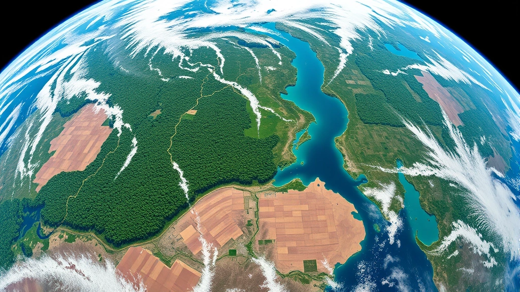
Remote sensing technology has fundamentally transformed how we observe Earth’s surface, offering real-time data on vegetation dynamics, water resources, atmospheric composition, and biodiversity patterns across scales previously inaccessible through ground-based observation alone. The journal’s rigorous peer-review process ensures that methodologies and findings meet the highest scientific standards, making it an indispensable resource for understanding the biophysical foundations of ecological economics and environmental sustainability.
Remote Sensing Technology and Ecosystem Monitoring
Remote sensing encompasses the detection and measurement of electromagnetic radiation reflected or emitted from Earth’s surface without physical contact. This technology utilizes sensors mounted on satellites, aircraft, and drones to capture multispectral and hyperspectral imagery across various wavelengths. The Remote Sensing of Environment journal publishes groundbreaking research on how these technological platforms enable scientists to monitor ecosystem health, track biodiversity patterns, and quantify critical environmental variables with spatial resolution ranging from centimeters to kilometers.
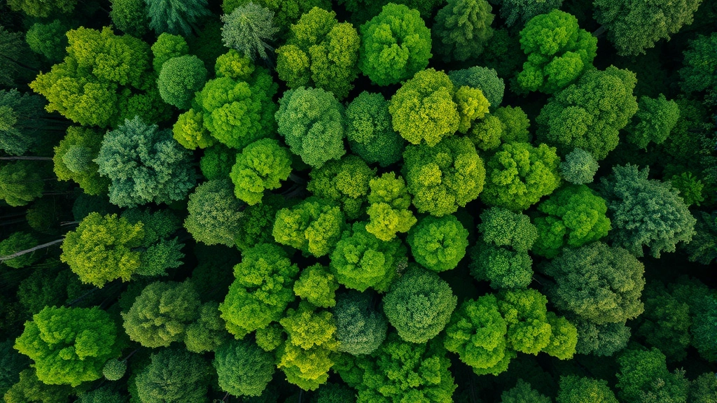
The journal’s coverage spans optical sensors (capturing visible and infrared light), radar systems (penetrating cloud cover), and thermal sensors (detecting heat signatures). Researchers published in this venue have demonstrated how synthetic aperture radar (SAR) provides all-weather monitoring capabilities essential for tropical rainforests and monsoon-affected regions. Multispectral analysis allows detection of vegetation stress, chlorophyll concentration, and moisture content—parameters fundamental to understanding ecosystem productivity and resilience. Such technological capabilities directly support the broader field of environment awareness by providing objective, scalable data on environmental conditions.
The journal emphasizes validation methodologies, ensuring that satellite-derived measurements correlate with field observations. This rigorous approach establishes remote sensing as a scientifically defensible tool for environmental assessment, critical for informing policy decisions and investment in conservation initiatives.

Journal Scope and Research Contributions
Remote Sensing of Environment accepts manuscripts addressing physical, chemical, and biological aspects of Earth’s land, ocean, and atmosphere. The journal’s interdisciplinary approach accommodates research from ecologists, geographers, atmospheric scientists, hydrologists, and environmental economists. Articles typically present novel algorithmic developments, sensor calibration techniques, or applications demonstrating how remote sensing addresses real-world environmental challenges.
Over its publication history, the journal has documented the evolution from single-band grayscale imagery to contemporary hyperspectral systems capturing hundreds of spectral bands simultaneously. Landmark papers have established protocols for monitoring forest cover change, quantifying coastal erosion, detecting harmful algal blooms, and assessing urban heat islands. The journal’s impact factor consistently ranks among the highest in environmental science, reflecting its influence on research agendas and policy development globally.
Recent issues feature research on phenological monitoring (timing of seasonal plant events), crop yield prediction, and ecosystem disturbance detection. These applications directly connect to our blog coverage of environmental topics, where data-driven insights inform sustainable practices. The journal’s emphasis on transparency and reproducibility aligns with contemporary scientific standards, requiring authors to provide code repositories and data access information alongside published findings.
Applications in Conservation and Land-Use Assessment
Conservation planning requires accurate, current information on habitat extent, fragmentation patterns, and species distribution. Remote sensing provides this foundational data layer at costs substantially lower than comprehensive field surveys. The journal publishes extensively on how satellite imagery identifies protected area effectiveness, monitors illegal logging in tropical forests, and tracks habitat restoration progress.
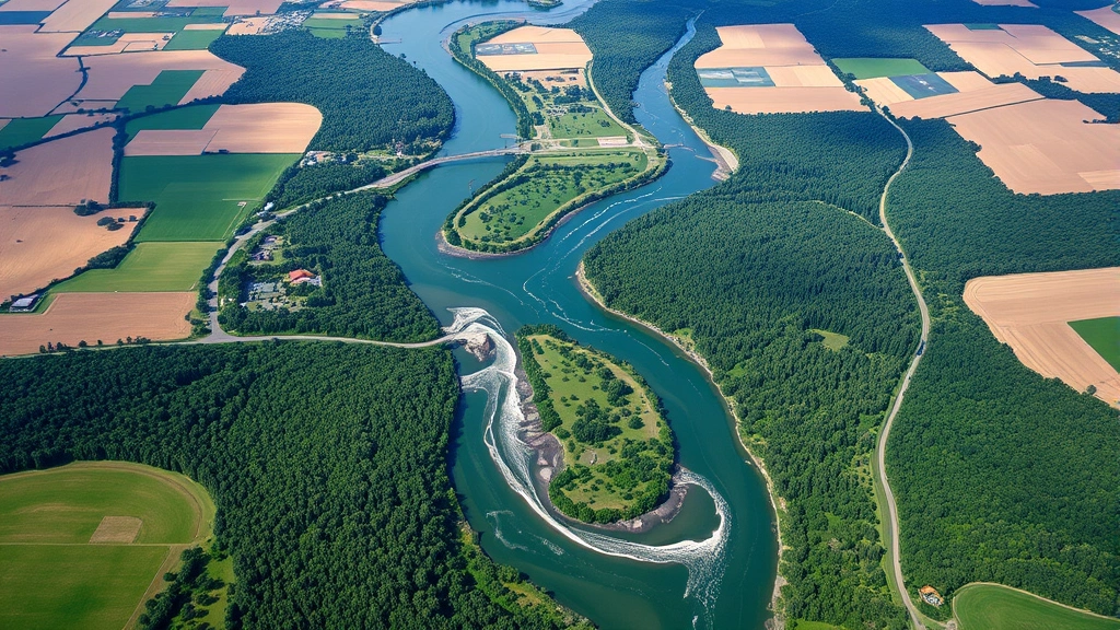
One critical application involves detecting land-use and land-cover (LULC) change. Researchers use temporal series of satellite images to quantify deforestation rates, agricultural expansion, urban sprawl, and wetland loss. Such data informs conservation prioritization, identifying regions experiencing rapid ecosystem transformation requiring urgent intervention. The journal’s methodological contributions include machine learning approaches that automatically classify satellite pixels, enabling analysis of continental-scale datasets previously intractable through manual interpretation.
Biodiversity assessment represents another major application domain. While remote sensing cannot identify individual species directly, it quantifies habitat characteristics—vegetation structure, moisture availability, and disturbance patterns—that correlate strongly with species richness and community composition. Articles in the journal demonstrate how structural diversity indices derived from high-resolution satellite data predict bird and mammal diversity across landscapes. This capability supports the environment and natural resources trust fund efforts by identifying high-conservation-value areas deserving investment and protection.
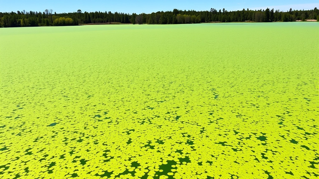
Marine conservation applications receive substantial coverage, with articles addressing coral reef monitoring, seagrass mapping, and mangrove extent quantification. These ecosystems provide critical fishery support and coastal protection services; remote sensing enables cost-effective monitoring across expansive ocean regions where field surveys prove logistically challenging and expensive.
Ecological Economics and Ecosystem Valuation
Ecological economics fundamentally recognizes that human economies depend upon natural capital—the stock of environmental assets providing ecosystem services. Remote sensing data quantifies this natural capital, enabling economists to assign monetary values to ecosystem functions and inform cost-benefit analyses of conservation versus development scenarios.
The journal publishes research on how satellite-derived productivity measurements support ecosystem service valuation. For instance, vegetation indices quantify carbon sequestration potential, allowing researchers to estimate the economic value of forests in climate change mitigation. Similarly, water quality indices derived from satellite imagery inform ecosystem service valuations related to freshwater provision and filtration. These economic applications recognize that reducing carbon footprint requires understanding the biophysical capacity of ecosystems to absorb and store carbon—knowledge increasingly derived from remote sensing analysis.
Payment for ecosystem services (PES) programs depend upon verifiable, transparent monitoring of environmental outcomes. Remote sensing provides this verification capacity, enabling governments and conservation organizations to demonstrate that protected areas maintain forest cover or that restoration projects successfully establish native vegetation. The journal documents how satellite-based monitoring reduces transaction costs in PES programs, making conservation investment more economically viable. UNEP research initiatives increasingly incorporate remote sensing for ecosystem valuation and environmental accounting.
Researchers published in this venue have quantified the relationship between ecosystem extent (measured through remote sensing) and ecosystem service provision, establishing empirical foundations for payment mechanisms. Articles address methodological challenges in scaling from satellite pixels to ecosystem service units, ensuring that economic valuations rest on sound biophysical understanding.
Climate Change Detection Through Satellite Data
Climate change manifests through multiple biophysical indicators detectable through remote sensing: shifting vegetation boundaries, earlier spring phenology, glacier and ice sheet mass loss, sea level rise, and altered precipitation patterns. The journal publishes extensive research documenting these climate-driven changes across decades of satellite observations.
Vegetation greenness indices (derived from multispectral imagery) reveal northward migration of tree lines in arctic regions and upslope migration in mountainous areas—physical evidence of warming-driven ecosystem reorganization. Articles document how satellite time series spanning multiple decades reveal these shifts with statistical rigor impossible through sporadic field observations. Similarly, thermal infrared data tracks changes in land surface temperature, revealing urban heat island intensification and altered surface energy budgets in response to land-cover change.
Cryospheric research—studying ice and snow—represents a major journal focus. Satellite radar and optical imagery quantify glacier retreat rates, snow cover extent changes, and permafrost degradation across the Arctic. These observations provide critical data for climate model validation and for understanding climate change impacts on water resources and sea level rise. The journal has published seminal work documenting accelerating ice loss in Greenland and Antarctica, translating remote sensing measurements into implications for coastal communities and global economics.
Precipitation monitoring through satellite radiometry provides global coverage in regions lacking ground-based weather station networks. This capability proves essential for understanding how climate change alters water availability—fundamental to agricultural productivity, hydroelectric generation, and ecosystem function. Research in the journal connects satellite-observed precipitation changes to terrestrial ecosystem responses, demonstrating cascading climate impacts.
Methodological Advances and Data Integration
The journal emphasizes methodological rigor and innovation in extracting meaningful information from increasingly complex remote sensing datasets. Recent articles address sensor fusion—combining data from multiple satellite platforms to leverage complementary strengths. Optical sensors provide high spatial detail; radar penetrates clouds; thermal sensors detect temperature variations. Integrated analysis of these diverse data streams yields more robust environmental assessments than single-sensor approaches.
Machine learning and artificial intelligence represent transformative methodological advances documented extensively in recent journal issues. Convolutional neural networks trained on labeled satellite imagery achieve unprecedented accuracy in land-cover classification, object detection, and change identification. These approaches enable analysis of massive satellite data archives—petabyte-scale collections—to detect patterns and trends imperceptible through traditional statistical methods. The journal has published foundational papers on deep learning applications to forest monitoring, urban mapping, and agricultural assessment.
Data integration challenges receive substantial attention. Researchers must reconcile observations from different satellite sensors operating at different spatial and temporal resolutions. The journal publishes methodologies for downscaling coarse-resolution data, upscaling high-resolution observations, and harmonizing historical datasets spanning multiple sensor generations. These technical advances enable creation of consistent, long-term environmental monitoring records essential for detecting change.
Uncertainty quantification represents another critical methodological focus. Remote sensing observations contain measurement error, classification uncertainty, and spatial variability. The journal emphasizes transparent reporting of uncertainty, ensuring that policy decisions informed by remote sensing data incorporate appropriate confidence bounds. Articles address how uncertainty propagates through analysis chains, from raw sensor calibration through final ecosystem assessments.
Global Case Studies and Regional Applications
The journal’s geographic scope spans all continents and ocean regions, with research addressing region-specific environmental challenges. Tropical forest research demonstrates how satellite monitoring detects illegal logging, quantifies deforestation drivers, and assesses reforestation success. Articles from the Amazon, Congo Basin, and Southeast Asia establish satellite monitoring as essential for implementing international forest protection commitments and World Bank climate finance initiatives.
Agricultural applications dominate research from developed nations, where satellite monitoring of crop phenology, water stress, and yield variation inform precision farming practices. The journal publishes research connecting satellite-derived vegetation indices to crop productivity, enabling farmers to optimize irrigation and nutrient application. Such applications demonstrate how remote sensing supports sustainable intensification—producing more food per unit of water and fertilizer input.
Coastal zone research addresses how satellite monitoring tracks mangrove loss, sea grass degradation, and coral bleaching. These ecosystems provide critical fishery support; their decline directly threatens food security and livelihoods for hundreds of millions of people. Remote sensing enables cost-effective monitoring across vast coastal regions, supporting marine protection efforts and fisheries management.
Urban research applications track sprawl patterns, green space fragmentation, and heat island development. Articles document how rapidly urbanizing regions in Asia, Africa, and Latin America undergo landscape transformation. Understanding these patterns through satellite monitoring informs urban planning decisions affecting sustainability and livability. The journal has published extensive work connecting urban remote sensing to socioeconomic outcomes and environmental justice considerations.
Future Directions and Emerging Technologies
The remote sensing frontier expands continuously as new satellite platforms launch and sensor technology advances. The journal anticipates increasing contributions from constellation missions—networks of small satellites providing rapid revisit times and flexible tasking. These systems enable near-real-time environmental monitoring, supporting rapid response to disasters and emerging threats.
Hyperspectral technology advancement promises enhanced ecosystem characterization. Rather than capturing multispectral data (typically 4-13 bands), hyperspectral systems acquire hundreds of narrow spectral bands, enabling detection of specific chemical constituents and subtle ecosystem conditions. The journal will likely feature expanding research on hyperspectral applications to forest health assessment, crop disease detection, and water quality monitoring.
Synthetic aperture radar (SAR) technology continues evolving, with emerging systems offering improved spatial resolution and polarimetric capabilities. SAR penetrates cloud cover and vegetation canopy, enabling ecosystem monitoring in perpetually cloudy regions and quantification of forest structural characteristics. The journal anticipates growing SAR contributions addressing tropical forest monitoring and wetland extent mapping.
Integration with artificial intelligence and autonomous systems represents another frontier. Machine learning approaches extract information from remote sensing data with minimal human intervention; autonomous systems optimize satellite tasking and data processing. The journal will document how these advances enable global-scale environmental monitoring with unprecedented frequency and consistency. Such capabilities support renewable energy development by identifying optimal locations for solar and wind installations based on satellite-observed resource availability.
Data democratization through open-access satellite imagery (Landsat, Sentinel, Harmonized Landsat-Sentinel) enables researchers and practitioners worldwide to conduct environmental monitoring. The journal emphasizes accessible science, publishing research utilizing freely available data and providing code repositories enabling reproducibility. This democratization expands remote sensing’s impact beyond academic institutions to government agencies, non-profits, and community-based organizations.
Integration of remote sensing with in-situ sensors and crowdsourced observations represents an emerging direction. Combining satellite data with drone observations, ground sensors, and citizen science creates multi-scale environmental understanding. The journal increasingly features research on sensor networks and data fusion, recognizing that comprehensive environmental understanding requires complementary observation approaches. Such integration strengthens the scientific foundation supporting sustainable practices by providing detailed understanding of environmental impacts across supply chains and production regions.
FAQ
What is the primary focus of the Remote Sensing of Environment journal?
The journal publishes peer-reviewed research on remote sensing technology applications to understanding Earth’s physical, chemical, and biological systems. It covers methodological advances, sensor development, and applications addressing environmental challenges including climate change, biodiversity loss, and ecosystem degradation.
How does remote sensing contribute to ecological economics?
Remote sensing quantifies natural capital and ecosystem service provision, enabling economists to value environmental assets and assess trade-offs between conservation and development. Satellite data supports verification of conservation outcomes, reducing transaction costs in payment for ecosystem services programs and informing cost-benefit analyses.
What satellite platforms provide data for research published in this journal?
Major platforms include Landsat (since 1972), Sentinel (European Copernicus program), MODIS (NASA), and commercial systems like Planet Labs and Maxar. The journal also features research using airborne sensors and emerging drone-based remote sensing. Many datasets are now freely available, enabling widespread scientific access.
How accurate are satellite-based ecosystem assessments?
Accuracy varies by application, sensor type, and ecosystem complexity. The journal emphasizes transparent uncertainty reporting; researchers validate satellite-derived results against field observations. Generally, accuracy ranges from 75-95% for land-cover classification, though structural ecosystem properties (biomass, canopy height) involve greater uncertainty.
What emerging technologies are transforming remote sensing applications?
Advances include hyperspectral sensors (capturing hundreds of spectral bands), improved synthetic aperture radar, constellation missions providing rapid revisit times, and machine learning algorithms extracting information from massive datasets. These technologies enable near-real-time monitoring and detection of subtle ecosystem changes previously unobservable.
How do researchers use remote sensing to monitor climate change?
Satellite observations track multiple climate indicators: vegetation greenness changes, shifting phenology, glacier and ice sheet mass loss, precipitation variations, and land surface temperature changes. Time series spanning decades reveal climate-driven ecosystem reorganization with statistical rigor impossible through field observations alone.